Riebo Technology is a national specialized and sophisticated "little giant" enterprise, focusing on the R&D and sales of aerial inspection and aerial surveying equipment.
ABOUT RIEBO
About Riebo
Riebo Technology is founded in 2015 and located in Chengdu, China. Riebo is the biggest aerial photography camera manufacturers in China with 200 employees and 35% of them are technical engineers. We develop, produce, and sell hardware for geospatial data acquisition systems, as well as offer data collection, processing, and application services that are both high-performance and reliable.
With core technologies in optics, inertial navigation, photogrammetry, and spatial data processing, Riebo Technology has established a reputation for delivering high-quality products and services. Under the high-end brand "RIEBO", we specialize in oblique photography, an area in which we are recognized by a large number of satisfied customers. 70% of China's mapping UAVs are equipped with Riebo main products.
10+R&D Experience
200+Employees
40+Countries Served
100+Global Distributors
MEMORABILIA
Development History
RIEBO2011MEMORABILIA
2011
Laying the Foundation, Starting the Journey
Mr. Yang, co-founder of Riebo Technology, identified the gap in the UAV aerial surveying industry and assembled a core research team from Southwest Jiaotong University and Chengdu University of Technology. They focused on R&D of UAV aerial photography and surveying technologies, successfully developing the first drone equipped with professional aerial photography equipment. They pioneered entry into professional aerial surveying services for governments, enterprises, and universities, laying a solid technical foundation for the company's subsequent specialization and industrialization.
RIEBO2013MEMORABILIA
2013
Focusing on the Track, Strategic Deepening
Precisely targeting the high-precision aerial surveying track, the company completed its business strategic focus and upgrading, becoming the official designated partner of the forestry department. With innovative aerial surveying technology, they implemented key projects such as precision forest pest monitoring and forestry resource surveying. Through professional technical service capabilities, the company established its industry position and reputation in the professional aerial surveying field.
RIEBO2015MEMORABILIA
2015
Company Founded, Self-Developed Breakthrough
Chengdu Riebo Technology Co., Ltd. was officially registered and established, pioneering the layout of the 3D oblique photography surveying core track. Addressing industry pain points of traditional aerial cameras being bulky, poorly adaptable, and inefficient, the company initiated dedicated R&D in miniaturization and lightweighting of oblique photography equipment, starting the path of independent innovation and import substitution for domestic high-end aerial surveying equipment.
2016
Lightweight Breakthrough, Product Launch
Riebo launched the industry-breaking miniature five-lens oblique camera S2, weighing only 1.2kg, which was 55% lighter than similar products on the market. It perfectly adapts to mainstream civil and industrial UAVs, completely solving the problems of difficult adaptation and operational limitations of traditional equipment. This marks that Riebo has achieved professional mass production of specialized imaging equipment for aerial surveying.
2017
Product Iteration, Industry Innovation
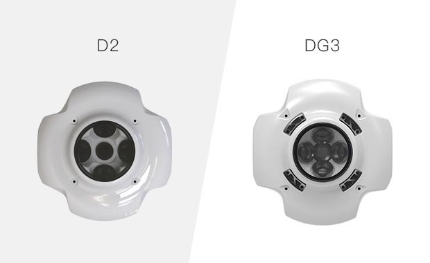
Riebo continuously broke through core hardware technologies, launching the revolutionary aerial surveying products D2 and DG3. The D2 camera weighs only 850g, equipped with a self-developed CMOS dedicated chip, weighing only 40% of industry competitors, with a 100% improvement in operational endurance. The upgraded DG3 model weighs as low as 650g, successfully adapting to fixed-wing UAV operation scenarios, creating a new era of lightweight high-precision aerial surveying equipment and redefining industry product standards.
2018
Core Technology Innovation, Building Barriers
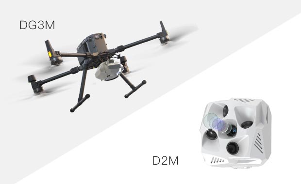
Riebo overcame core underlying industry technologies and pioneered the world's first professional aerial measurement MLE lens and MLS shutter technology. Equipped on the newly iterated D2M and DG3M models, lens distortion and image aberration are significantly reduced, image matching accuracy increased by 50%, and shutter service life exceeded 500,000 times. Stability, accuracy, and durability fully lead the industry, achieving a leapfrog breakthrough in domestic aerial surveying core technologies.
With extreme equipment stability and high-precision mapping capabilities, Riebo was selected as the official designated aerial photogrammetry system supplier for China's Antarctic scientific expeditions. The company has successively provided complete aerial survey equipment and customized technical solutions for the 37th through 42nd Antarctic research missions, successfully completing high-precision geographic information data collection in polar regions. The company's technical strength has been rigorously verified through national-level extreme scenarios.
2020
Benchmark Product, Defining Industry Standards
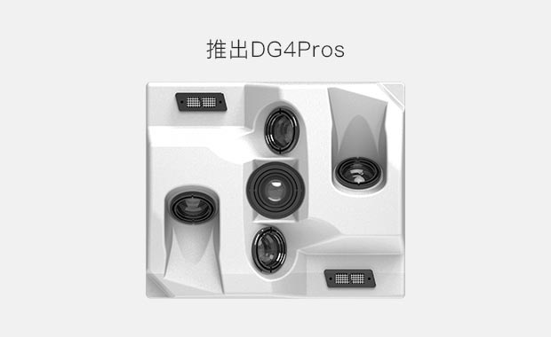
Riebo launched the flagship revolutionary product DG4Pros, weighing only 960g, equipped with a 200-megapixel full-frame five-lens architecture. Imaging precision, detail restoration, and modeling fineness achieved a comprehensive upgrade, capable of generating ultra-high-precision 3D models, perfectly matching the high-precision requirements of professional surveying and urban 3D modeling. Upon launch, this product became the industry benchmark for drone oblique photography cameras, and remains a strong technology leader today, driving industry quality standard upgrades.
2021
Leading the Market, Closed-Loop Iteration
Product services fully covered the national surveying market, with the industrial-grade aerial surveying camera market share firmly ranking first in the industry, exceeding 70%. Relying on massive industry operation data and user application feedback, the company built a closed-loop innovation system of "R&D - implementation - application - iteration", continuously optimizing product performance and upgrading functional adaptation, forming unique technical iteration advantages and further consolidating industry leadership.
2022
Matrix Upgrade, Full-Scenario Coverage
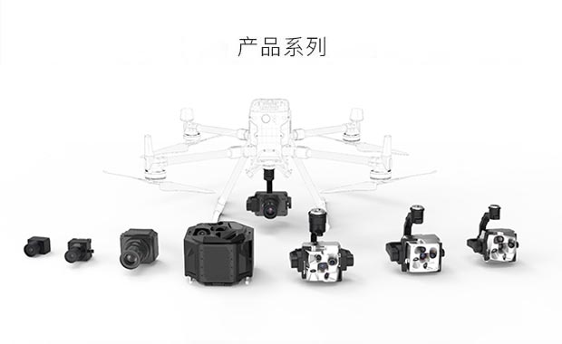
Riebo completed a comprehensive upgrade of the entire product matrix, building a full-dimension aerial surveying equipment ecosystem from entry-level to flagship. Successively launched cost-effective medium-format aerial cameras M10 and M15, the medium-format five-lens camera DG10 with dual breakthroughs in image quality and efficiency, completed the technical iteration of the full-frame flagship DG6pro, and launched the cost-effective DG4M and DG6M series. This significantly lowered the application threshold for professional high-precision aerial surveying, comprehensively meeting surveying needs across different industries and scenarios.
RIEBO2023MEMORABILIA
2023
Breaking Monopoly, Independent Control
Riebo formally launched the landmark product DG10 medium-format 500-megapixel aerial camera, relying on the fully self-developed camera core architecture, successively overcoming multiple core high-end aerial surveying technologies. With the core advantages of ultra-high precision, ultra-high efficiency, and ultra-high stability, the company successfully broke the long-term technical monopoly of overseas brands on large-format high-end aerial cameras, achieving complete independent control of domestic high-end aerial surveying equipment, providing core domestic productivity support for the construction of 3D Real China.
RIEBO2024MEMORABILIA
2024
Computing Power Upgrade, Refining Full-Scenario Capabilities
Riebo completed the self-developed upgrade of core chip architecture and launched a new generation of intelligent surveying cameras. The newly upgraded processor significantly optimizes image noise reduction, shortening the exposure interval to 0.5 seconds, comprehensively improving the operational accuracy and overall efficiency of aerial surveying and urban 3D modeling. It precisely adapts to full-scenario professional operation needs including oblique photography, topographic mapping, and urban reality modeling.
Riebo deepened its spatial information intelligent upgrading, achieving large-scale commercial application of self-developed core algorithms including AI 3D modeling, intelligent image correction, and automated data processing. Through deep algorithm-hardware integration, manual post-processing workflows are significantly reduced, with overall modeling efficiency improved by over 40%. The company has comprehensively improved its full-chain service capability of "hardware acquisition + intelligent computation + result output", and continues to iterate polar-specific aerial survey equipment for extreme environment adaptability.
RIEBO2026MEMORABILIA
2026
Full-Domain Control, Accelerating Globalization
Riebo achieved full-process domestic substitution of key components including camera cores, core sensors, and intelligent control systems, completely eliminating external technical dependence. Core products have achieved 100% independent R&D and production, with product stability, supply capacity, and cost-effectiveness leading the industry. The company accelerates its globalization strategy, improving overseas distribution and technical service systems. Products and solutions have been deployed in Southeast Asia, Central Asia, South America and other overseas markets, undertaking multiple cross-border 3D mapping and geographic information collection projects.
Certificate & Patent
Honors & Certifications
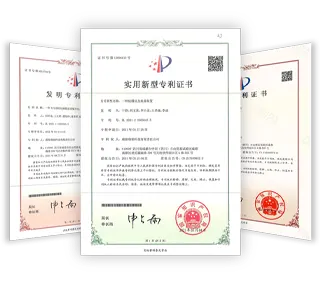
Riebo's long-term accumulation in core technologies, intellectual property, and enterprise qualifications
Patent Certificate
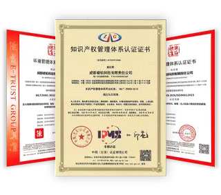
System Certificate
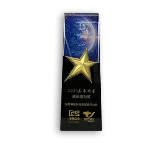
Innovation Award
Other Awards
NEWS CENTER
News Center
Focusing on aerial mapping and infrastructure inspection, sharing technology trends and industry practices
This website uses cookies to improve your browsing experience and analyze site traffic. By clicking "Accept All", you consent to the use of all cookies. Learn more




.webp)