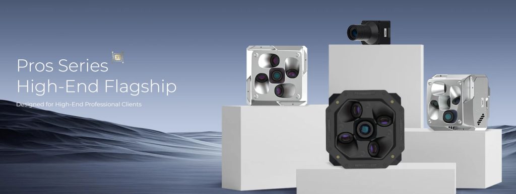
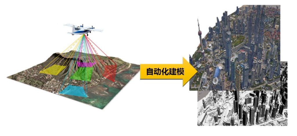
As the core technology for 3D real-scene modeling, the hardware design of oblique photography cameras directly influences data acquisition efficiency and model quality. Among numerous lens configurations, the five-lens structure (downward-looking + front, rear, left, and right oblique views) has become the industry mainstream. This design is not accidental but a comprehensive result based on rigorous technical requirements and application validation.
I. Multi-Angle Synchronous Acquisition: The Cornerstone of Efficiency and Accuracy
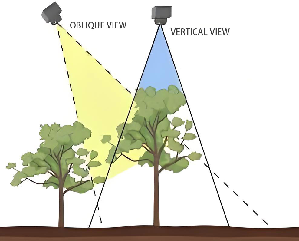
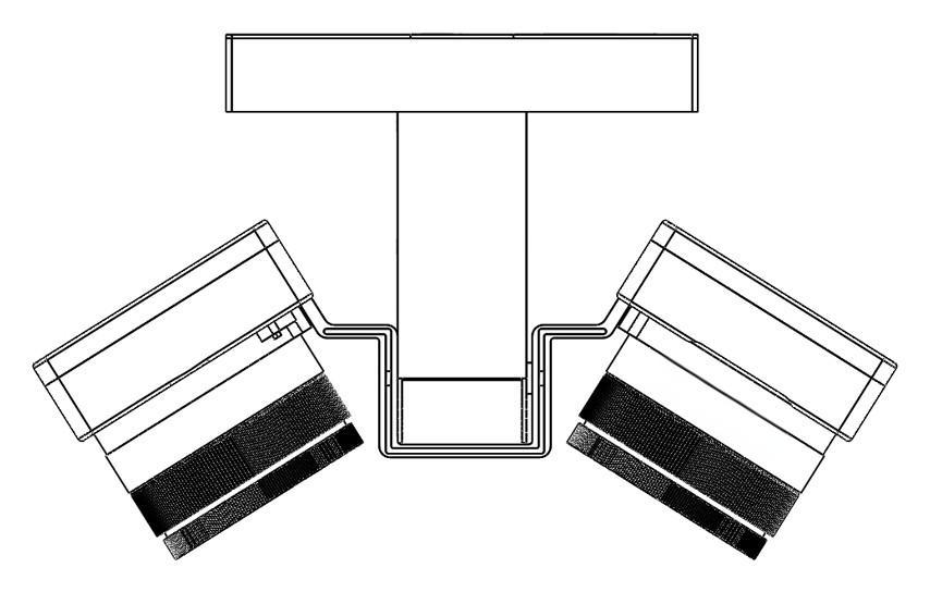
Omni-directional Coverage Design The five-lens camera, through its fixed-angle optical system (typically with the nadir lens perpendicular to the ground and the four oblique lenses distributed at 45°), simultaneously captures both the top surface and the surrounding vertical facades of ground objects in a single exposure. This design ensures that images from all five perspectives correspond precisely to the same spatial location.
Eliminating Motion Errors When a UAV flies at high speed, a dual-lens camera using a "continuous flight exposure" mode can experience decimeter-level position shifts between two exposures, leading to layered misalignments in aerial triangulation calculations. In contrast, with millisecond-level synchronous exposure (error < 1ms) supported by the five-lens camera, images from all five perspectives share perfectly consistent spatial coordinates, significantly reducing the complexity of post-processing.
Limitations of Single-Lens Cameras While single-lens cameras offer lower hardware costs for oblique photography and can adapt to small-scale, low-cost modeling needs by integrating a rotating gimbal or intelligent swing function (like DJI Zenmuse P1), their drawbacks are also prominent. Since a single lens cannot simultaneously acquire multi-angle information, it requires multiple back-and-forth flights and mechanical angle adjustments to capture data, resulting in low data acquisition efficiency (flight time is 3-5 times that of a five-lens system). Moreover, images captured at different times are prone to matching errors due to UAV position shifts and light changes. Furthermore, they lack redundant data support, leading to higher missed shot rates when facing obstructions, and a greater risk of model voids or layered misalignments, making it difficult to meet the demands of complex urban scenes or high-precision surveying and mapping.
II. Core Guarantee for Data Completeness
The Critical Role of the Nadir View Dual-lens cameras often suffer from missing nadir views (partially compensated by mechanical swings, but with low efficiency), leading to data gaps and model voids in areas like building crevices and narrow streets. The five-lens camera's nadir lens directly captures the texture of the top surface of ground objects, combined with the oblique lenses capturing facade details, ensuring full element coverage in complex scenes (e.g., urban building clusters, geological disaster sites).
Redundant Data Enhances Robustness The overlapping fields of view of adjacent oblique lenses (typically a side overlap rate ≥80%) create data redundancy. When a single lens fails due to obstruction, other lenses can provide supplementary information, significantly reducing the missed shot rate (in actual operations, the missed shot rate is much lower than with single/dual-lens systems).
III. Key Technological Breakthroughs for Engineering Implementation
Lightweighting and Structural Optimization Early five-lens cameras weighed over 2kg, severely limiting UAV flight endurance. New generation products (such as Riebo D2M) have reduced the total weight to 630g through integrated CNC aviation aluminum molding and single-camera weight reduction design, making them compatible with DJI M300 series UAVs while maintaining a 45-minute flight time.
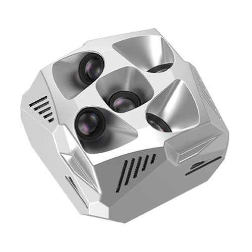
Distortion Control and Optical Enhancement The optical components of Riebo's five-lens cameras utilize ultra-low dispersion aspherical ED lenses, compressing the lens distortion rate to ≤0.4%. Coupled with fixed-focus mapping lenses and UV filters, they achieve high-sharpness, low-chromatic aberration imaging, meeting 1:500 scale mapping precision requirements.
Innovation in Positioning Synchronization Technology
- Independent POS Recording: Each lens independently records high-precision position and attitude information (centimeter-level positioning accuracy), directly written into the photo EXIF attributes, eliminating the need for manual post-matching.
- RTK/PPK Deep Integration: By directly receiving differential signals through the UAV flight control system, the problem of meter-level GNSS drift in ordinary systems is resolved, preventing model layering errors.
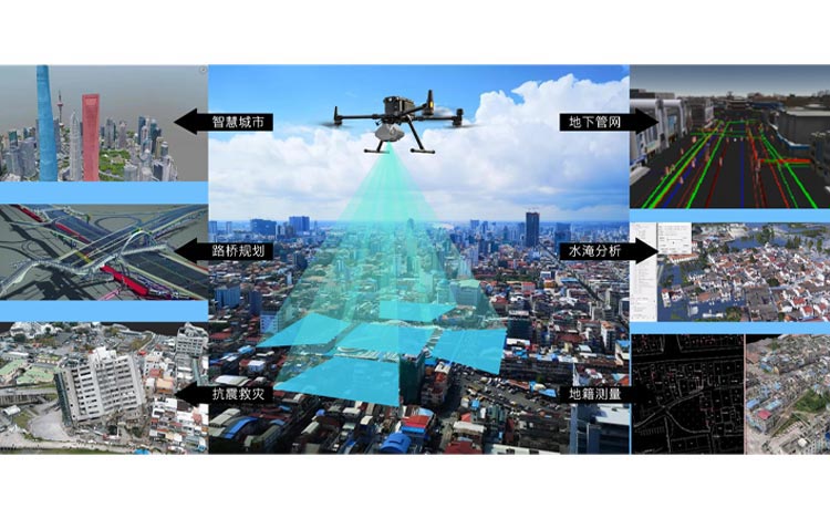
IV. Application Scenarios Validate Design Rationality
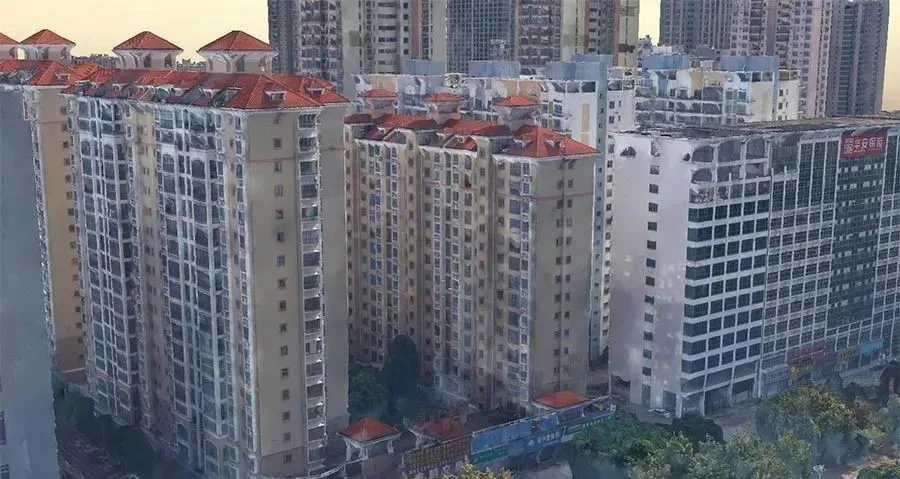
Geological Disaster Emergency Response In geological landslide and earthquake sites, Riebo DG4Pros five-lens cameras can quickly generate centimeter-level real-scene 3D models. Their full-frame sensors (45 million pixels per single lens) and intelligent exposure control ensure clear images even in complex environments with dust or rain, supporting rescue route planning and secondary disaster assessment.
Large-Scale Engineering Control-Point-Free Mapping In integrated rural housing projects, the five-lens camera, combined with DJI SmartMap software, enables control-point-free operations. The camera's built-in five-phase self-inspection system and active temperature control function ensure stable continuous operation, improving field work efficiency by more than 3 times compared to traditional manual mapping or single-lens solutions.
The widespread adoption of the five-lens configuration signifies the transition of oblique photography technology from experimental exploration to practical engineering application. Essentially, it solves the core pain points in 3D modeling – "incomplete capture, inaccurate alignment, and low efficiency" – through a triple coupling of spatial coverage completeness, temporal synchronization precision, and efficient data acquisition.