In modern cadastral surveying and urban planning, ground control–free photogrammetry is revolutionizing traditional workflows. This article takes the Yulong County “Beautiful County” Construction Project in Lijiang as a case study, detailing how Riebo’s oblique photography technology was applied in a 1:500-scale topographic survey without ground control points. It outlines the complete technical workflow and outcomes, providing practical experience for similar high-altitude and complex-terrain mapping projects.
1. Project Background: Precision Mapping Empowering Urban Construction
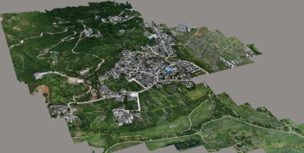
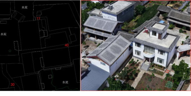
In June 2020, the Yunnan Geological and Mapping Institute undertook the 1:500-scale oblique photography and topographic mapping project for Yulong County’s “Beautiful County” development. Covering an area of about 30 square kilometers, the project required high-precision oblique aerial photography with better than 3 cm accuracy. Based on the generated 3D models, the team extracted elevation points, topographic features, and landmark details to produce DLG (Digital Line Graph) and DOM (Digital Orthophoto Map) outputs meeting industry standards—providing reliable geographic data support for county-level planning and construction.
2. Survey Area Overview: Dual Challenges of High Altitude and Complex Terrain
The mapping area lies in the southwest of Yulong County, Lijiang, combining mountainous and flat terrain—posing challenges to aerial flight operations.
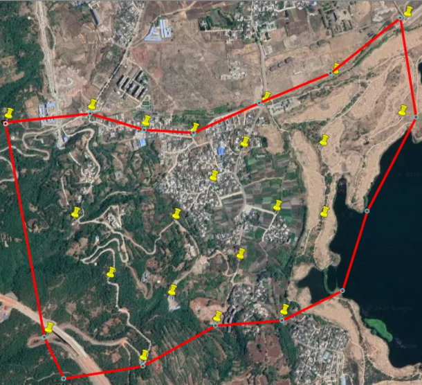
- Elevation Range: 2380–2600 m, with a 220 m height difference.
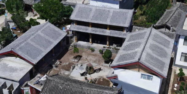
- Land Features: Low-rise buildings (2–3 floors, under 15 m) with regular spatial distribution.
- Weather Conditions: Flights conducted between 9:00 a.m. and 4:00 p.m., under mild winds (2–3 levels) and stable light conditions.
- Accuracy Verification: 24 ground checkpoints were established for data validation and precision evaluation.
3. Equipment and Flight Design: Scientific Planning for High-Quality Data
Core Equipment:
The project used a DJI M600 Pro UAV equipped with a DG4Pros camera, offering stable performance in high-altitude environments and meeting high-resolution imaging requirements.
Flight Design:
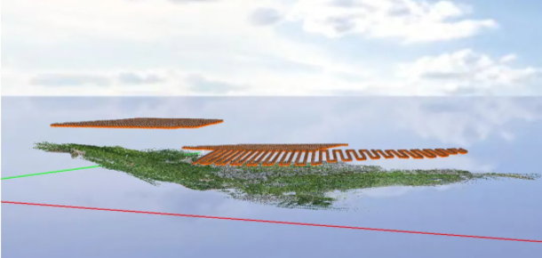
To adapt to terrain variations, a differentiated flight strategy was adopted:
- Flight Altitude: 140 m, achieving a GSD (Ground Sampling Distance) of 1.6 cm.
- Overlap Settings: 80% forward and 70% side overlap in flat areas; 75% forward and 65% side overlap in mountainous zones.
- Data Output: 7 flight missions covering 2.35 km², producing 15,935 high-quality images for subsequent modeling and analysis.
4. Data Processing: Efficient Software Workflow for Precision Results
Image Filtering: Using sky-filter software, redundant images were removed, retaining 12,457 valid photos (21.8% discard rate) to optimize processing efficiency.
3D Modeling: Processed with Smart3D 2019, the data produced accurate 3D models and feature points for DLG and DOM generation.
5. Results: Accuracy Validation of Ground Control–Free Photogrammetry
Checkpoints and data assessments confirmed that, even without any external ground control points, the UAV data captured by DJI M600 Pro with DG4Pros camera achieved accuracy fully compliant with 1:500 cadastral mapping standards. This demonstrates the reliability of oblique photogrammetry without ground control in high-altitude and moderate-relief terrain, effectively reducing costs and improving operational efficiency.
6. Practical Insights: Key Takeaways for Risk Prevention
Based on this project, three critical lessons were summarized for oblique photogrammetry in complex terrain:
- Define Terrain-Based Flight Surfaces: Divide flight areas by elevation levels to ensure uniform overlap and resolution.
- Account for Vegetation Height: Adjust flight parameters considering tree height to prevent insufficient overlap or data voids.
- Optimize Camera Settings for Altitude: Adjust exposure and ISO for bright high-altitude conditions to improve image clarity and color accuracy, reducing post-processing complexity.


