Every high-quality product must be proven through real-world application. True capability requires no empty words — results speak for themselves.
In this case study, Gansu Dayu Jiuzhou Spatial Information Technology Co., Ltd. successfully completed a 1:1000 topographic mapping project in Tianshui City, Gansu Province using the Riebo DG3 Pros oblique photography camera, and further integrated BIM technology to create a 3D bridge construction simulation, providing strong technical support for project planning.
Project Background & Requirements
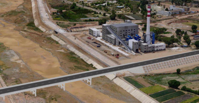
To relieve urban traffic pressure, enhance regional connectivity, support tourism development, and promote the integration of local political, economic, and cultural resources, a new bridge is planned to connect the east and west banks of the project area.
Based on project requirements, a 1:1000 topographic survey was needed, combined with BIM modeling to complete the 3D structural design of the bridge. Considering the terrain conditions, the project team chose UAV oblique photography with the Riebo DG3 Pros camera to rapidly capture high-fidelity real-scene imagery. The BIM model enabled real-time scheme adjustments and 3D visualization, supporting construction planning, scheme comparison, and technical review.
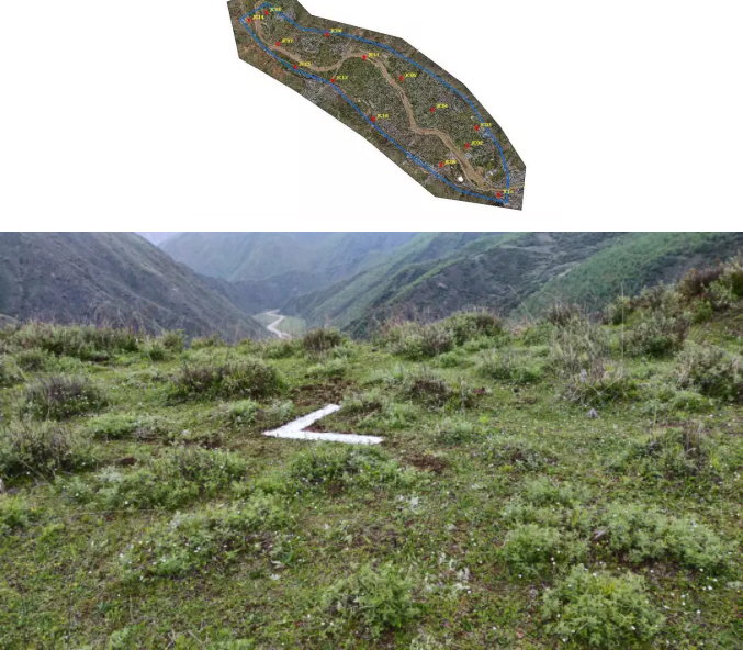
The survey area is located in a composite zone between the northwest slope of the Qinling Mountains and the southwest edge of the Longzhong Loess Plateau, with an annual average temperature of 10.3°C and a pleasant four-season climate. The terrain inclines from west to east and south to north, with an elevation difference of approximately 150 meters. Land use is mainly farmland, grassland, and residential areas, with mountains distributed along both sides of the river valley.
Aerial photography was conducted between 10:00–11:00 AM under clear skies, moderate lighting, and level-3 breeze — ideal flight conditions.
To ensure accuracy, 14 ground control points (GCPs) and 14 checkpoints were set throughout the area for precision verification.
Equipment Selection
Due to the valley terrain — long, narrow, and with large elevation differences — a multi-platform UAV system was used:
Large-area Surveying
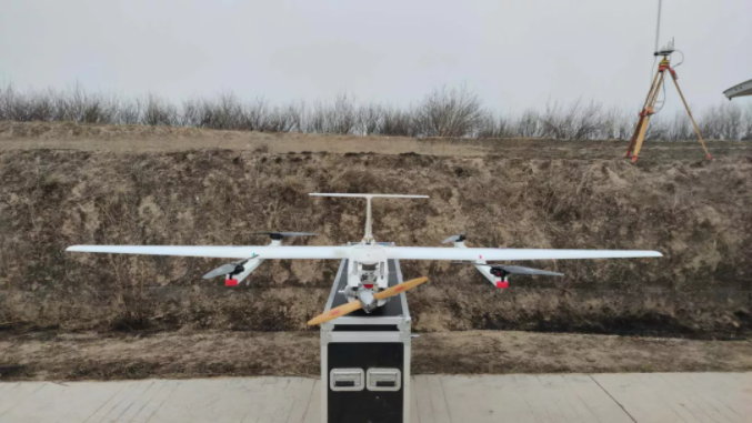
Vertical take-off and landing (VTOL) UAV equipped with Riebo DG3 Pros.
Key Bridge Design Area
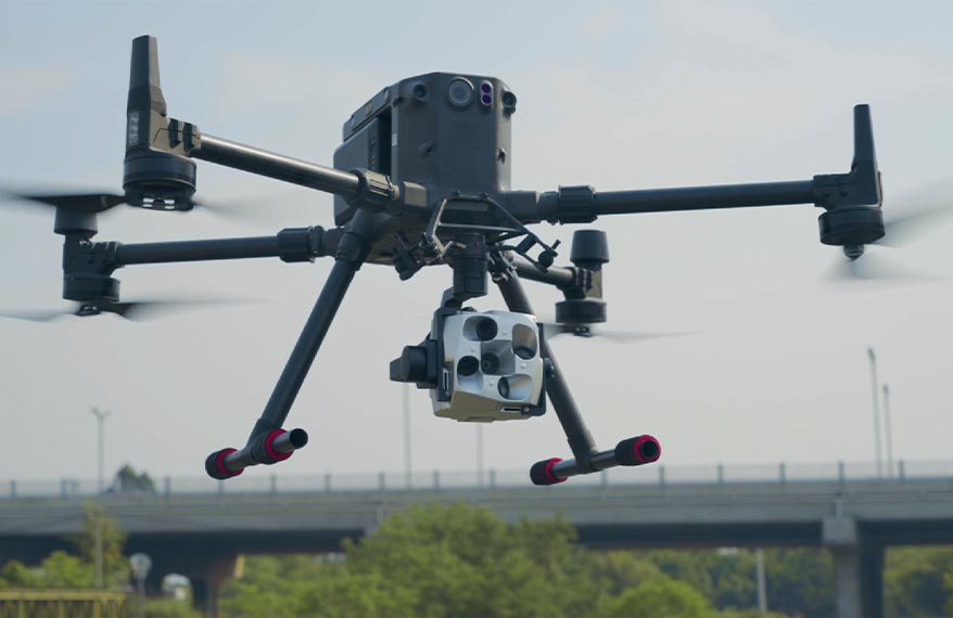
DJI M600 Pro rotor UAV carrying DG3 Pros for high-resolution imaging.
Field Verification Equipment
Hi-Target V60 GPS-RTK to ensure accuracy of checkpoint measurements.
Technical Advantages of Riebo DG3 Pros
- Dual focal lengths 28/43, compatible with both fixed-wing and multirotor UAVs.
- Longer focal lengths than typical 25/35 mm cameras, ensuring required GSD while maintaining safe flight altitude.
- Low-distortion, low-chromatic-aberration ED lenses greatly improve the quality of raw images.
These advantages ensure excellent data quality for aerial triangulation and model reconstruction.
Aerial Survey & Data Processing Overview
Aerial Survey Parameters
- Flight altitude: 560 m
- GSD: 8 cm (bridge area refined to 2 cm)
- Survey area: ~14 km²
- Forward overlap: 70%
- Side overlap: 65%
The fixed-wing UAV completed 1 flight mission lasting approx. 80 minutes, capturing 5,650 images — all clear and evenly exposed.
The rotor UAV collected a smaller dataset in the key region and is not described in detail here.
Data Processing Workflow
Pre-processing
Using SkyScanner to automatically complete data sorting, renaming, orientation calculation, and generation of block files compatible with CC software.
Redundant Image Removal
Using SkyFilter, redundant oblique images outside the flight strips were removed.
- Original images: 5,650
- Removed: 2,253
- Valid images: 3,397
- Removal rate: 39.87%
Aerial Triangulation (AT)
After cleaning, AT processing took less than 4 hours.
A single run met reconstruction accuracy requirements — significantly improving efficiency and ensuring rapid 3D model generation.
This streamlined processing system serves as a powerful tool for “high-efficiency indoor AT densification” and provides valuable experience for future emergency mapping tasks.
Accuracy & Conclusions
Accuracy Verification
Using 14 checkpoints, final accuracy results were:
- Horizontal RMSE: 0.08 m
- Vertical RMSE: 0.053 m
Both fully meet 1:1000 topographic mapping standards.
Core Value of the Project
This project innovatively integrates oblique photography and BIM modeling, merging DOM, DEM, true 3D models, and manually designed BIM models into a unified spatial design platform.
This approach:
- Leverages the strengths of 3D reality modeling in documenting spatial information;
- Overcomes visualization limitations in traditional planning;
- Provides rich scene-browsing capabilities to assist decision-makers in evaluating bridge design proposals from multiple angles;
- Offers precise guidance for construction, scheme selection, and technical review.


