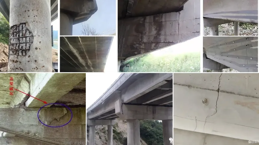
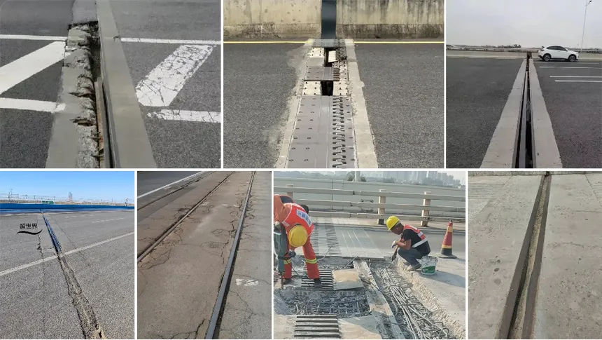
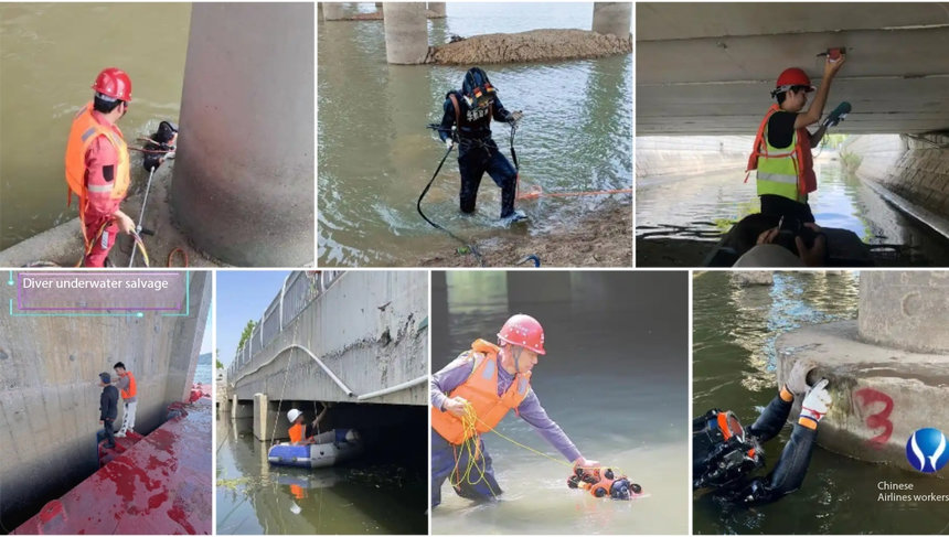
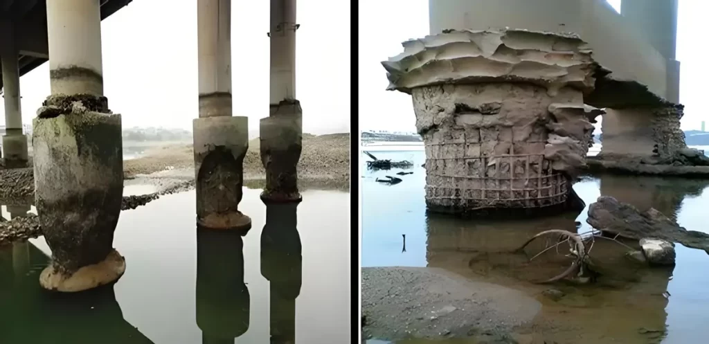
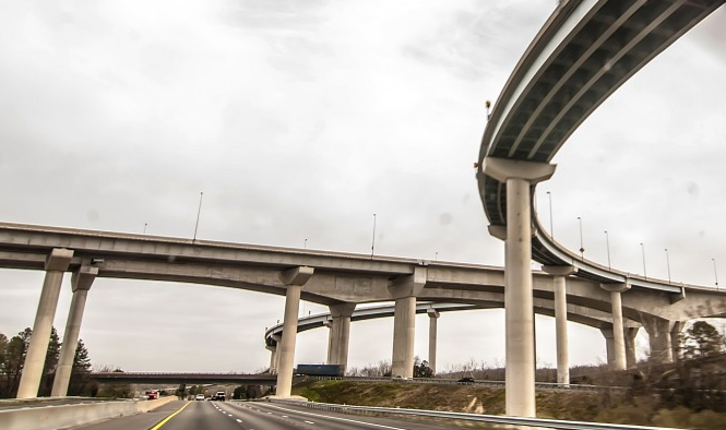
For decades, bridge inspection has relied heavily on manual methods. Inspection teams typically used bridge inspection vehicles or boats to carry engineers close to bridge structures. Inspectors would then visually identify defects using the naked eye or tools such as binoculars.
Although this approach has been widely used, it comes with several limitations. Traditional bridge inspections often require traffic control, involve significant safety risks for workers, and can leave inspection blind spots in hard-to-reach areas. In addition, the process is time-consuming and expensive.
In recent years, however, the rapid development of digital technologies and drone platforms has begun to transform the bridge inspection industry. Drone-based inspection is gradually replacing manual visual inspection and has become an increasingly popular solution for infrastructure monitoring.
Compared with traditional climbing inspections, drone inspection significantly reduces safety risks associated with high-altitude work while improving inspection coverage. More importantly, it enables continuous, multi-dimensional, and data-driven bridge health monitoring.
However, drone inspection under bridges presents its own technical challenges—particularly related to navigation and positioning.
Why GPS Often Fails Under Bridges
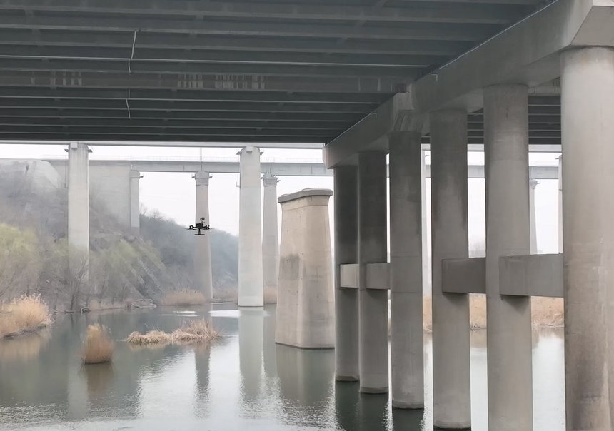
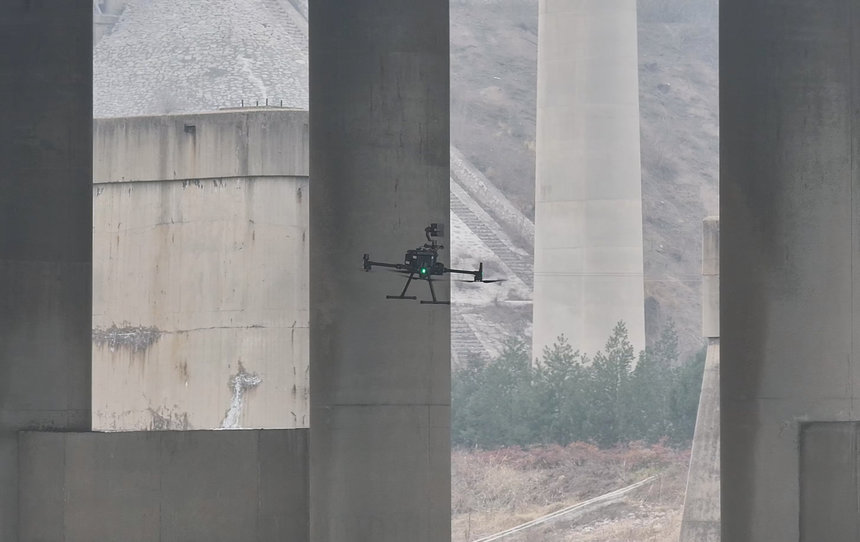
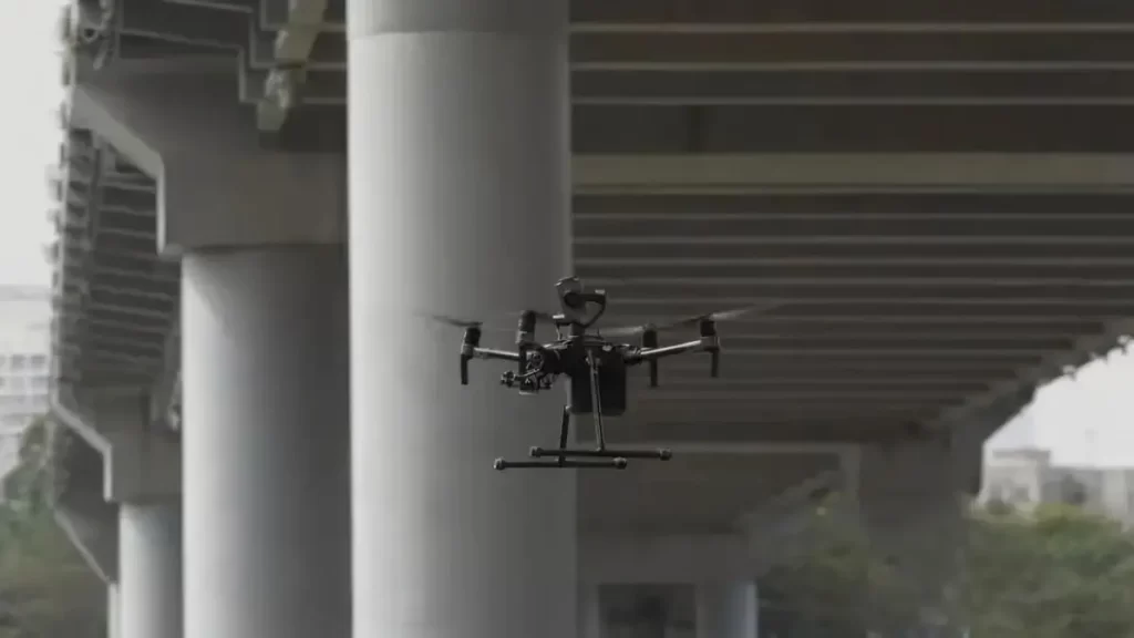
One of the biggest challenges in drone bridge inspection occurs when drones operate under bridge decks or within complex steel-concrete structures.
Bridge structures can create strong electromagnetic shielding effects, which interfere with GNSS satellite signals. As a result, drones may experience:
- Signal multipath interference
- Satellite signal attenuation
- Positioning jumps or loss of signal
When a drone enters the space beneath a bridge deck, metal structures and reinforced concrete can reflect and block satellite signals. In these environments, navigation accuracy may degrade from centimeter-level positioning to meter-level errors.
In severe cases, this loss of positioning accuracy can disrupt the drone’s flight controller calculations, potentially causing unstable flight behavior or deviation from planned inspection routes. These challenges historically limited the ability of drones to inspect critical areas such as:
- Bridge undersides
- Piers and abutments
- Structural joints and bearings
Because of these issues, many infrastructure owners once questioned whether drones could reliably operate beneath bridges.
Today, however, advances in navigation technologies have largely solved this problem.
How Drones Navigate Without GPS
Early drone systems relied almost entirely on GPS for navigation. When satellite signals became unstable or unavailable, drones often struggled to maintain accurate positioning.
To overcome this limitation, researchers and engineers have developed multi-sensor navigation systems based on multimodal perception. These systems allow drones to “see,” “sense,” and “remember” their surroundings using different types of sensors.
Several key technologies now make GPS-denied bridge inspection possible.
Inertial Navigation Systems (INS)
An Inertial Navigation System (INS) allows drones to estimate their position by measuring acceleration and angular velocity in real time.
Using onboard sensors such as accelerometers and gyroscopes, the system calculates motion and converts it into position estimates relative to a bridge coordinate system.
One major advantage of inertial navigation is that it does not rely on external signals, meaning it can function even when GPS is unavailable.
However, INS has an inherent limitation: small errors accumulate over time. For this reason, inertial navigation systems typically require periodic correction using other sensors.
Geomagnetic Navigation
The Earth’s magnetic field varies slightly across different locations. By measuring magnetic field strength and direction, drones can compare these measurements with pre-built geomagnetic maps to estimate their position.
This method provides another reference for navigation in GPS-denied environments.
However, geomagnetic navigation can be affected by nearby metal structures. Since bridges often contain large amounts of steel, magnetic interference can reduce the accuracy of this method.
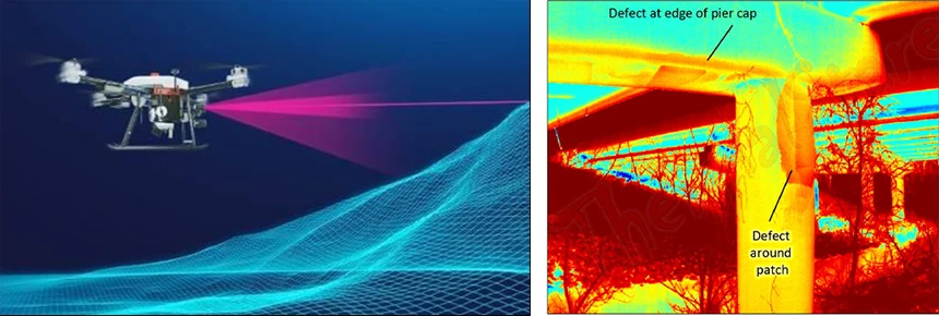
LiDAR-Based Navigation
LiDAR (Light Detection and Ranging) navigation systems emit laser beams and measure the time it takes for the reflected light to return. This process allows drones to build detailed 3D models of their surrounding environment.
Using these models, drones can:
- Detect obstacles in real time
- Maintain safe flight distances from structures
- Plan stable flight paths beneath bridge decks
LiDAR plays a critical role in enabling drones to navigate complex bridge geometries safely.
Visual Odometry
Another important technology is visual odometry, which functions like a drone’s “visual memory.”
By analyzing sequential images captured by onboard cameras, the drone tracks changes in visual features within the environment. This allows the system to estimate motion and orientation.
Visual odometry is particularly useful for tracking movement along surfaces such as bridge girders or piers. However, its performance may be reduced in environments with poor lighting, such as tunnels or extremely dark bridge undersides.
Multi-Sensor Fusion and SLAM Technology
While each navigation technology offers certain advantages, no single system can reliably handle all inspection scenarios. To address this limitation, modern drone inspection platforms combine multiple sensors using multi-source data fusion algorithms.
This approach integrates the strengths of several technologies, including:
- MEMS-based inertial navigation
- Geomagnetic sensing
- Solid-state LiDAR scanning
- Visual simultaneous localization and mapping (SLAM)
Through machine learning and adaptive weighting algorithms, these systems analyze multi-scale sensor data in real time. The result is highly reliable positioning performance with centimeter-level accuracy and extremely high confidence levels.
Visual SLAM
Visual SLAM systems create real-time maps using visual features on bridge surfaces. In some implementations, artificial markers such as QR codes may also assist localization.
LiDAR SLAM
LiDAR SLAM builds detailed 3D point cloud maps of bridge structures. These maps enable accurate obstacle avoidance and route planning for drones operating in complex environments.
Sensor Redundancy
Additional sensors—including barometers, ultrasonic sensors, and inertial measurement units—provide redundant measurements to compensate for individual sensor limitations and improve overall system stability.
The Impact on Bridge Inspection Efficiency
Thanks to advances in multi-sensor fusion and navigation technologies, drone bridge inspection has matured into a reliable and widely adopted solution.
Compared with traditional manual inspection methods, drone inspection can:
- Increase inspection efficiency by 5–8 times
- Reduce inspection costs by 40–60%
- Improve safety by minimizing high-risk manual operations
- Expand coverage of hard-to-reach structural areas
These advantages have made drone inspection one of the most important technologies for modern bridge health monitoring systems.
The Future of Drone Bridge Inspection
In the past, the underside of bridges was often considered a “dead zone” for drone inspection. GPS signals were blocked by concrete structures, and positioning errors could reach tens of meters.
Today, breakthroughs in multi-sensor navigation and SLAM technology are enabling drones to operate reliably even in these complex environments. With centimeter-level positioning accuracy and advanced perception systems, drones can now inspect areas that were once extremely difficult or dangerous for human inspectors.
As infrastructure networks continue to age worldwide, intelligent inspection technologies will play an increasingly critical role in maintaining structural safety.
Riebo’s Drone Bridge Inspection Solution
To support the growing demand for efficient infrastructure monitoring, Riebo has developed an advanced drone-based bridge inspection solution designed for complex bridge environments.
Riebo’s Drone Bridge Inspection Solution integrates:
- High-resolution drone imaging systems
- Intelligent flight planning for complex bridge structures
- Multi-sensor navigation and positioning technologies
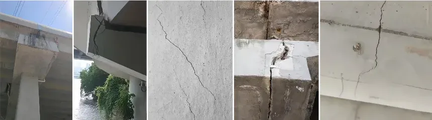
- AI-based defect detection and analysis
- 3D modeling for digital bridge documentation
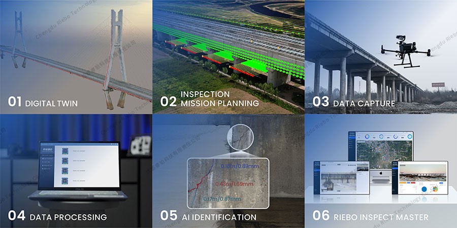
By combining drone technology with advanced data processing, the solution helps infrastructure managers perform safer, faster, and more accurate bridge inspections, improving both inspection efficiency and long-term maintenance planning.