In bridge maintenance, traditional inspection methods are often limited by high-altitude safety risks, expensive labor costs, and incomplete data coverage. Drone-based bridge inspections are becoming a core method for structural health monitoring thanks to their flexibility, safety, and efficiency. Based on years of practical experience and industry best practices, this article shares key insights into drone bridge inspections across three dimensions: planning & preparation, on-site execution, and data processing. These insights help practitioners minimize risks and improve inspection quality.
1. Planning & Preparation: Defining Objectives and Building a Solid Foundation
The accuracy of a drone bridge inspection is determined as early as the planning stage. Unlike generic survey missions, bridges are complex structures (including decks, piers, bearings, suspension cables, etc.) and are often located in high-traffic or river-crossing areas. This requires more detailed and targeted preparation.
(1) Define Inspection Goals and Key Targets
It is essential to clarify inspection objectives with bridge management authorities in advance. The focus may vary: identifying cracks and corrosion, assessing bearing displacement, detecting deck damage, or evaluating emergency impacts after floods or typhoons.
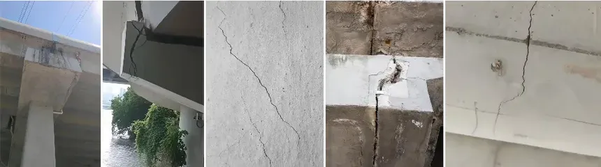
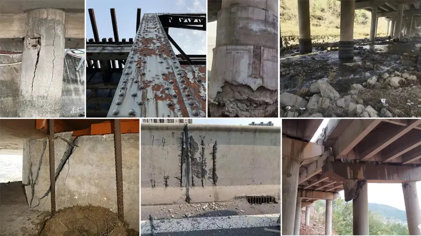
- For concrete bridges, inspections focus on honeycombing, surface spalling, and vertical cracks on piers.
- For steel bridges, weld corrosion, bolt looseness, and fatigue issues take priority.
Once objectives are clear, a “critical inspection checklist” can be created to ensure no key areas are missed.
(2) Site Assessment to Avoid Risks
Site reconnaissance is indispensable, usually conducted in two steps:
- Ground survey: Record bridge dimensions (length, height, span), identify obstacles (power lines, trees, ships), and select safe take-off/landing sites such as open parking areas near bridge ends. For river-crossing bridges, check water flow and wind patterns to prevent low-altitude flight risks.
- Airspace approval: Many bridges are in controlled airspace. Operators must submit flight plans to aviation authorities, specifying inspection time, range, and altitude (typically within 10 m above the deck). Property-use permissions from bridge owners are also required to ensure compliance.
(3) Custom Flight Plans for Bridge Structures
Unlike standard grid missions, bridge inspections require structure-specific flight paths:
- Deck inspections: Use parallel flight paths 3–5 m below the deck, ensuring clear imagery of the underside. For box girders, additional cross paths should be flown to capture inner corners.
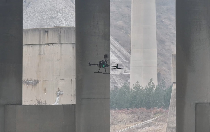
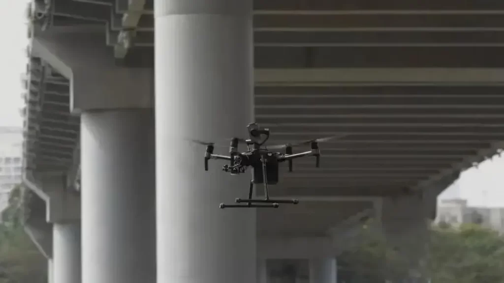
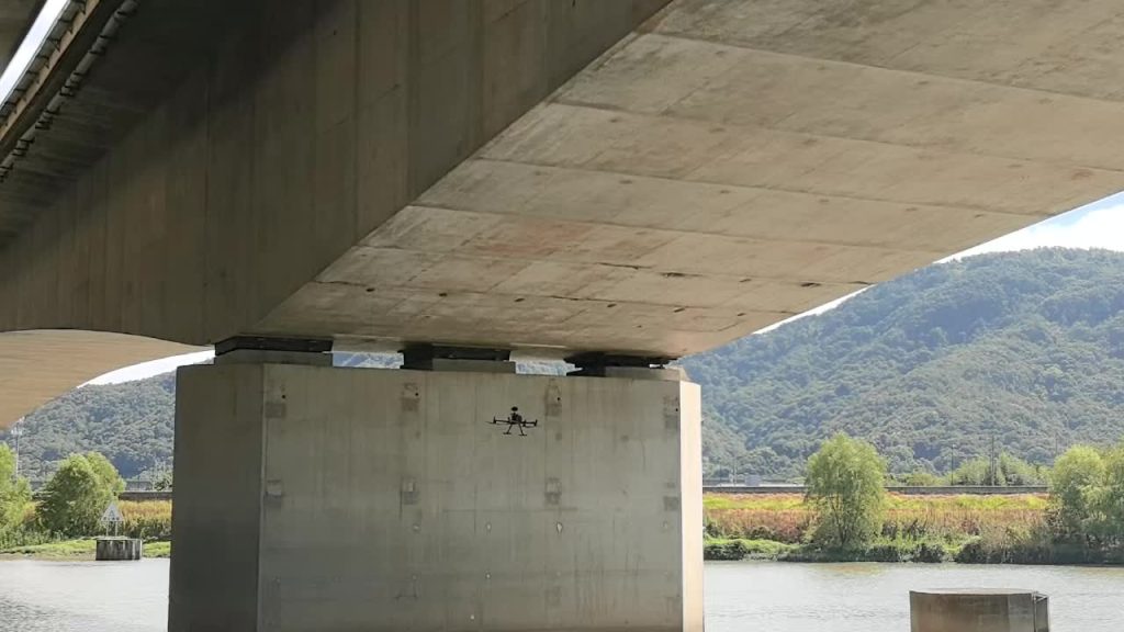
- Pier inspections: Conduct spiral flights around piers, with 80%+ overlap, scanning from bottom to top. For tall piers, split into segments, pausing between to confirm image clarity.
- Bearings and deck surfaces: Use “hover points” for close-up shots 1–2 m in front of bearings. For deck surfaces, a longitudinal grid flight ensures complete coverage of potholes, cracks, and joint damages.
(4) Choosing the Right Equipment and Backup Gear
- Drone platforms: Multirotor UAVs (e.g., DJI M300 RTK) for stability in close-range tasks; fixed-wing UAVs for long-span bridges (1 km+).
- Sensors:
- High-resolution RGB cameras (20MP+) for general defects.
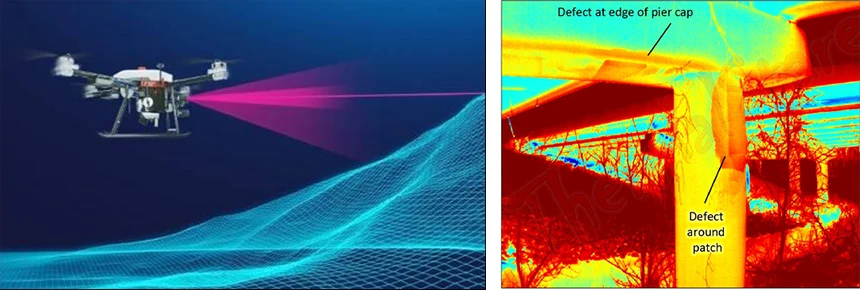
- Thermal imaging for hidden voids or steel corrosion.
- LiDAR for displacement monitoring and high-precision 3D modeling.
- Backups: At least three fully charged batteries (30 min each, with 10 min reserved for emergencies), spare propellers, cables, and lens cleaning kits.
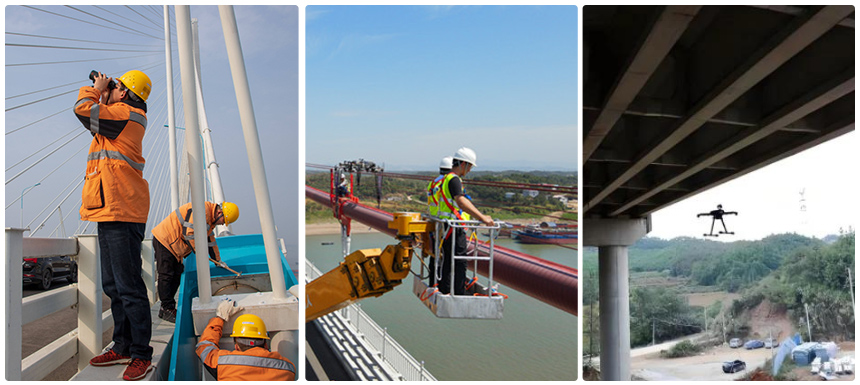
2. On-Site Execution: Safety First, Data Accuracy Guaranteed
When on site, safety is the top priority, followed by ensuring reliable, usable data.
(1) Maintain VLOS and Real-Time Monitoring
Visual Line of Sight (VLOS) is a non-negotiable rule. Inspections should use two-person teams:
- A pilot focusing on flight control.
- A data operator monitoring live feed to detect blurriness or occlusions.
In one case on a river-crossing bridge, the drone temporarily disappeared behind trees. The observer used RTK positioning to guide the pilot, avoiding drift over the river.
(2) Monitor Weather and Adjust Plans Dynamically
Weather is a silent risk. Operations stop if:
- Wind speed exceeds 5 m/s.
- Rain or fog reduces visibility below 1 km.
In mountainous inspections, sudden gusts forced an emergency return-to-home maneuver, preventing collision. In hot weather, batteries require cooling; in cold conditions (<0°C), heating pads are needed to maintain endurance.
(3) Emergency Response Plans
Operators must rehearse scenarios for quick action:
- GPS loss: Switch to ATTI mode and manually control the drone, or use “home point memory” for safe return.
- Equipment failure: Trigger emergency hover or land at a safe nearby spot instead of forcing return.
- Electromagnetic interference: Lower altitude and exit the danger zone quickly; pause flights if manned aircraft enter nearby airspace.
3. Data Processing: From Raw Data to Actionable Insights
The true value of UAV inspections lies in turning data into actionable results.
(1) Data Quality Control
- Imagery: Remove blurred, overexposed, or obstructed images; verify thermal calibration accuracy.
- Point cloud & models: Check for gaps (e.g., missed pier bases) and flag them for re-flights.
(2) Professional Software Analysis
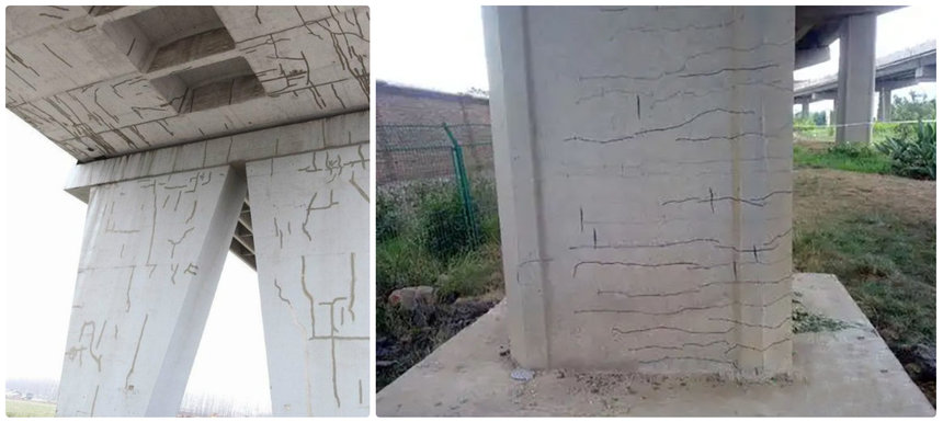
- RGB images: Photogrammetry software (e.g., Pix4Dmapper) generates orthophotos and 3D models, with defects measured and classified (e.g., “concrete crack 3m x 2mm”).
- Thermal data: FLIR Tools identifies voids or corrosion from temperature anomalies.
- LiDAR data: GIS software (e.g., ArcGIS) compares time-series point clouds to measure displacement (e.g., bearing shift >5 mm).
(3) Structured Inspection Reports
Reports should balance professional depth with clear readability:
- Current status: Charts and annotated images highlighting defects.
- Risk assessment: Classify severity and repair urgency.
- Recommendations: Propose specific measures (e.g., epoxy crack repairs, anti-rust coatings), and schedule follow-up UAV inspections.
(4) Data Archiving for Long-Term Monitoring
All data (photos, models, reports) should be archived systematically in cloud storage with backups. This enables year-to-year comparisons, regulatory compliance, and continuous structural health tracking.
Conclusion
Drone bridge inspection is not simply “fly and capture photos” — it is a systematic process of planning, execution, and analysis. From detailed site surveys and safety protocols to rigorous data processing, each step requires expertise and discipline.
With future advances such as AI-based defect recognition and multi-drone swarm inspections, the workflow will become more efficient and intelligent. Yet the core principles remain unchanged: safety, data accuracy, and actionable outcomes.
These practical experiences aim to guide practitioners in improving UAV bridge inspections, ensuring safer and more reliable bridge maintenance.
If you are looking for a professional drone bridge inspection solution, RieboTech can provide an integrated service covering everything from flight platform selection and data acquisition to AI defect detection and digital twin management. Contact us today to make your railway bridge maintenance safer and more efficient.