1. Project Overview
Urban 3D reality modeling based on oblique photogrammetry is increasingly used in city construction, planning, and renovation. In this case, a detailed large-scale 3D model was created to support the urban renovation of an old residential area in Xiantao City, providing high-resolution spatial data for planning, design, and decision-making.
The high-definition 3D model not only supports renovation planning, but also serves as a baseline for updating 1:500 topographic maps, enhancing digital urban management and visualization during city renewal.
2. Client Introduction
The Xiantao Urban Survey & Design Institute was established in 1988 and operates under the City Construction Investment & Development Company. It holds multiple professional qualifications for surveying, engineering investigation, urban planning, design, and geospatial information services.
Its work scope includes:
- Engineering surveying and topographic mapping
- UAV aerial photogrammetry and GIS
- Urban and rural planning
- Engineering design and consulting services
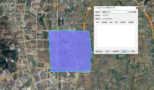
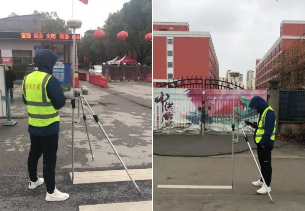
3. Survey Area

The urban area of Xiantao City (Hubei Province, China) covers approximately 70 km². The terrain is mostly flat with average height variation within 15 m, and the city center includes:
- Dense old residential buildings (3–8 stories)
- New urban areas with high-rise buildings (18–33 stories)
The entire municipal area was mapped to deliver a comprehensive urban model.
4. Equipment Selection
For this project, the following equipment and software were deployed:
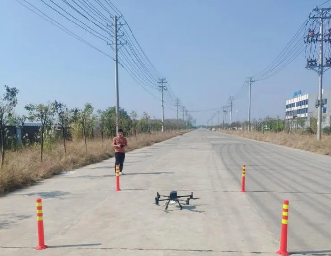
- UAV Platform: DJI M300 RTK
- Aerial Payload: Riebo D2-PSDK oblique photogrammetry camera
- Modeling Software: Bentley ContextCapture
The D2-PSDK delivers high-resolution aerial imagery with consistent color and precise geometry — ideal for urban 3D modeling tasks.
5. Flight Operation
- Flight Altitude: 150 m
- Ground Resolution: ~2.3 cm per pixel
- Overlap: 80% forward, 70% side
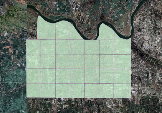
- Flight Strategy: The area was divided into 66 sub-blocks for efficient UAV flight control.
- Sorties & Data: ~150 flight sorties captured ~600,000 aerial images.
- Image acquisition was carefully timed between 10:00–15:00 to ensure consistent lighting across the city.
6. Data Processing & Modeling
6.1 Pre-Processing
Riebo’s SkyScanner software was used to preprocess image metadata and GPS/IMU pose (“POS”) data, generating XML files that can be imported directly into modeling software — greatly reducing manual steps and improving workflow efficiency.
6.2 Aerial Triangulation & 3D Reconstruction
Data was processed on a high-performance workstation cluster by dividing the project into 32 subblocks. Each subblock was processed separately before merging into larger blocks to ensure seamless model integration and consistent color balance.
6.3 Model Production
After aerial triangulation and merging, the 3D model was assembled into six major blocks, producing a complete city-scale 3D reality model. These outputs were optimized for smooth rendering and web visualization.
7. Results & Deliverables
The finished urban reality model provides:
📌 Photorealistic city visualization
📌 Seamless 3D geometry from old to new districts
📌 Multi-resolution tiles for efficient web use
📌 Base data for planning and renovation simulation
The 3D data were integrated into the city renovation planning workflow. Designers used the model to evaluate architectural changes, visualize demolition vs. reconstruction impact, plan new elevators, and test facade color design — enabling data-driven decision making for city revitalization.
8. Practical Applications
This urban reality model has been applied to:
- Old residential area renovation planning
- Real-time visualization and communication with stakeholders
- 3D design evaluation and comparison (before vs. after demolition)
- Urban infrastructure planning and utilities adjustment
9. Challenges & Lessons Learned
Urban 3D modeling at city scale presents several technical challenges:
✔ Maintaining continuous UAV signal coverage in high-density urban canyons
✔ Ensuring adequate overlap for rooftop and street-level detail
✔ Dividing large datasets into manageable modeling blocks to avoid software crashes
✔ Balancing image overlap and resolution for both ground and rooftop perspectives
✔ Ensuring seamless integration of multiple photogrammetric blocks into a unified model