In response to national requirements for rural planning and topographic mapping standards, the project was tasked with producing high-precision topographic maps of designated rural settlement areas and their surrounding key zones at different scales (1:500–1:1000 for core zones, 1:5000–1:10000 elsewhere). The goal was to deliver accurate terrain mapping data to support village planning and resource management in a complex loess plateau landscape.
Client Overview
Gansu Kaiyuan Survey, Planning & Design Consulting Co., Ltd. is a regional surveying and planning firm based in Lanzhou, Gansu Province. The company holds surveying qualifications and provides services including land planning, geographic information services, remote sensing mapping, and natural resource evaluations — supporting regional spatial planning and environmental assessments.
Survey Area Description

- Location: A hilly, loess-terraced region in Linxia Prefecture, Gansu Province, China.
- Terrain: Highly undulating with elevation differences up to ~270 m and dense gullies.
- Land Cover: Mix of farmland, grassland, woodland, rural roads, and residential clusters with low-rise structures (< 10 m).
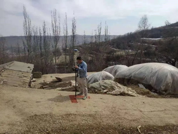
- Climate & Flight Conditions: Flights were conducted between 09:00–17:30 under cloudy skies with moderate light and light breeze — ideal for UAV photogrammetric operations.
Equipment & Technical Configuration
To address the challenges of large terrain variation and areas of weak texture (which can negatively impact photogrammetric accuracy), the team selected:
- Drone Platform: DJI M300 RTK
- Camera: Riebo D2M oblique photogrammetry camera
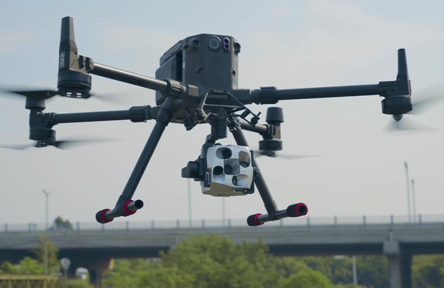
This setup offered stable flight performance, high-quality imagery, and reliable data for subsequent modeling and topographic analysis.
Flight Mission Planning
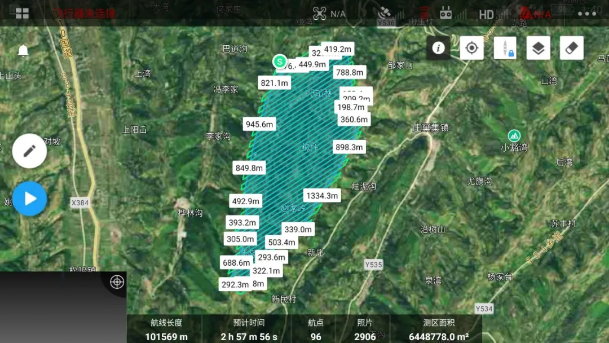
- Planned Flight Altitude: ~280 m
- Ground Sampling Distance (GSD): ~4.39 cm
- Overlap Configuration: ~80% forward / ~70% side
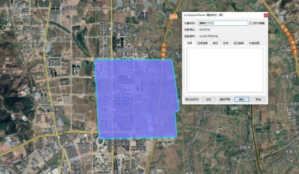
- Coverage: ~6.4 km² effective area; ~7 km² actual flown area due to buffer margins
- Sorties: 9 total flights
- Flight Speed: ~10 m/s
- Captured Images: 15,300 images featuring clear focus and uniform illumination — meeting both geometric and photogrammetric requirements.
Data Processing & Workflow
Pre-Processing:
Using Riebo’s SkyScanner software, raw POS data were calibrated and POS-corrected XML files were generated, significantly reducing manual import time and risk of errors.
Aerial Triangulation & Modeling:
Photogrammetric processing was carried out in Smart3D software with a high-performance cluster (one high-end workstation plus four mid-range machines). Outputs included aerial triangulation reports, dense point clouds, and surface models.
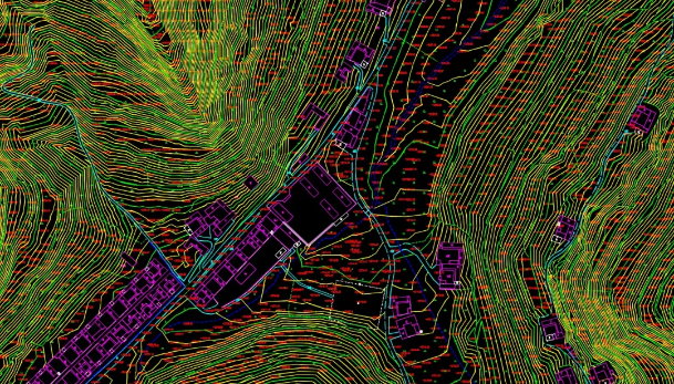
Production of Topographic Outputs:
Digital Line Graphic (DLG) topographic maps were produced using CASS10.1, accurately representing terrain, contour lines, and feature vectors suitable for map drafting and use in planning workflows.
Model Evaluation & Result Highlights
- The M300 RTK + Riebo D2M imaging system delivered data that fully met the 1:500 topographic mapping accuracy standard.
- High image quality and stable lens calibration ensured consistent photogrammetric performance, even in weak-texture areas and steep terrain.
- The integrated SkyScanner workflow improved efficiency and reduced processing time, which is critical for large-area mapping projects.
Application & Deliverables
This project’s outputs now support:
- Rural village planning and design with accurate terrain and surface mapping
- Topographic base maps for infrastructure planning and local spatial management
- GIS integration for natural resource assessments and environmental monitoring