1. Project Overview
The Lin-Tao–Kangle–Guanghe Expressway (S36) is a key national and provincial highway project in Gansu Province, China, connecting Linxia, Gannan, and Southwest regions and serving as an important component of the national highway network. This project required high-precision topographic and 3D terrain data to support highway design, earthwork estimation, BIM integration, and construction decision-making. To meet these goals in rugged mountainous terrain, the survey team applied UAV-based oblique photogrammetry with Riebo’s advanced imaging systems to capture aerial imagery and generate detailed 3D models.
2. Client Introduction
Gansu Haiwei Highway Survey & Design Co., Ltd. is a subsidiary of the Gansu Provincial Transportation Planning, Survey & Design Institute Co., Ltd. The company specializes in highway planning, design, surveying, and geographic information services. With extensive experience and certified professionals, the firm has delivered UAV mapping solutions on multiple major infrastructure projects.
3. Survey Area Characteristics

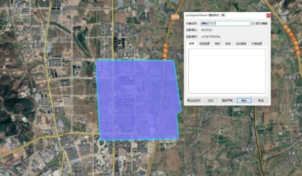
- Location: The S36 expressway corridor across Lin-Tao County, Kangle County, and Guanghe County in Gansu Province.
- Terrain: Steep slopes with elevation differences exceeding 100 m; scattered low-rise residential clusters and mixed natural landscapes.
- Weather & Flight Conditions: Aerial operations were conducted in clear weather with moderate lighting and light winds, ensuring excellent UAV image quality.
4. Equipment & Technical Setup
To balance safety, coverage, and image quality over mountainous terrain, the project selected:
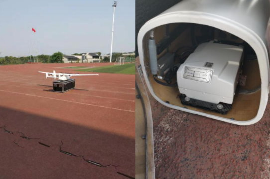
- UAV Platform: Vertical take-off fixed-wing drone (type CW-15) — offering efficient long-range coverage.
- Photogrammetry Camera: Riebo DG4 Pros Oblique Photogrammetry Camera — with a long focal length and full-frame sensor to improve detail capture and model quality even at higher flight altitudes.
- Ground Control: RTK/PPK GPS measured control points for georeferencing and accuracy validation.
5. Flight Mission & Data Acquisition
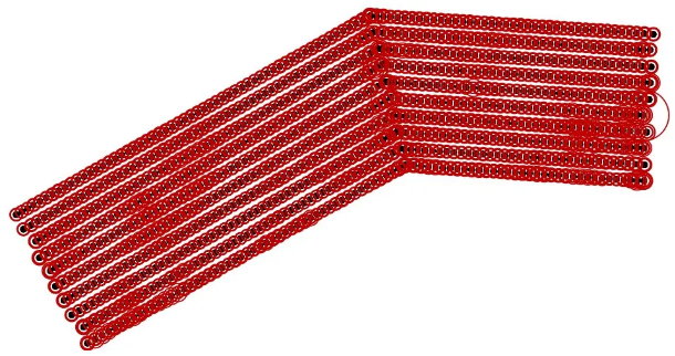
- Planned Flight Altitude: ~350 m
- Ground Sampling Distance (GSD): ~4.5 cm
- Territory Coverage: Effective survey ~55.6 km² (actual flown ~70.2 km² due to buffer margins)
- Flight Overlaps: Forward ~80%, Side ~70%
- Total Sorties: 8 flights with ~42 min per sortie
- Captured Imagery: 27,800 images with uniform color balance and sharp focus — meeting mapping and modeling requirements.
6. Data Processing & 3D Model Generation
Processing Workflow:
- Quality Control & Preprocessing: Images were filtered (4,170 removed), leaving 23,630 valid photos.
- Photogrammetric Reconstruction: Using ContextCapture with multi-node processing (17 nodes), the team completed dense point cloud generation, mesh construction, and texture mapping.
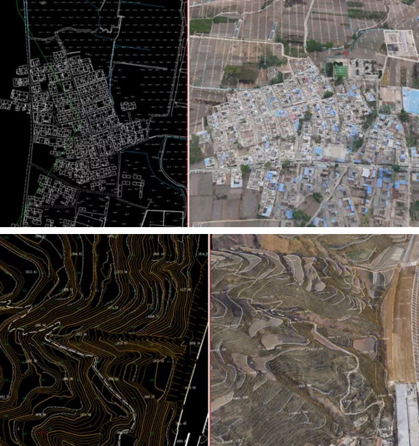
- Topographic Deliverables: Final 3D model outputs were imported into EPS for stereo vector extraction, producing 1:2000 digital line graphic (DLG) and digital terrain models (DTM).
- Accuracy Validation: Ground checkpoints were used to confirm geometric precision.
7. Project Results & Quality
- Model Quality: The 3D terrain model exhibited high geometric fidelity and texture continuity across complex mountainous features.
- Mapping Precision: Validation showed horizontal and vertical errors well within specification, meeting national highway survey standards and design requirements.
- Deliverables: Fully-featured 3D terrain model, high-resolution orthophotos, DTM/DSM products, and vector map layers for design and BIM integration.
8. Practical Applications & Benefits
The UAV oblique photogrammetry solution significantly enhanced multiple stages of highway project delivery:
✔ streamlined highway alignment design by providing accurate terrain context
✔ enabled rapid earthwork volume estimation and cut/fill analysis
✔ supported BIM platform visualization for design, progress tracking, and clash detection
✔ reduced field survey time and cost compared to traditional terrestrial methods
✔ improved decision-making with comprehensive 3D data integration
The 3D model also served as a base for BIM coordination, construction verification, and high-fidelity visualization in engineering workflows.