1. Project Background
In highway planning and design, acquiring high-precision topographic data and realistic 3D models is essential for route selection, engineering analysis, and construction planning. Traditional surveying methods often struggle in mountainous areas due to limited accessibility, low efficiency, and incomplete data capture.
With the rapid development of UAV-based oblique photogrammetry, project teams can now efficiently obtain high-resolution, multi-angle geographic data, significantly improving both accuracy and workflow efficiency.
This case demonstrates how Riebo’s drone mapping solution was applied in a mountain highway survey project, supporting accurate design and decision-making.
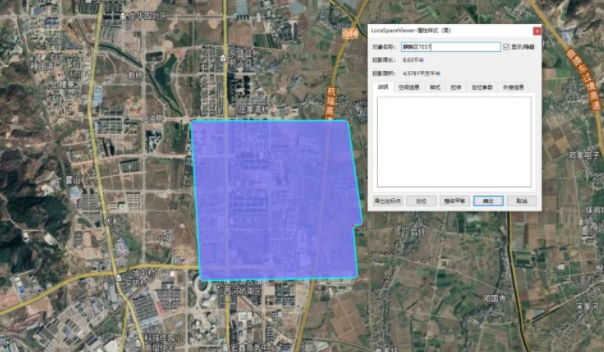
2. Survey Area Overview

The project is located in a mountainous region with complex terrain characteristics:
- Elevation difference exceeding 100 meters
- Dense distribution of low-rise buildings (2–4 floors)
- Mixed land cover including farmland, vegetation, and residential areas
Such terrain conditions pose challenges for traditional survey methods, including:
- Difficulty in accessing steep or remote areas
- Limited visibility for complete data capture
- High labor and time costs
UAV aerial surveying provided a more efficient and safer alternative.
3. Equipment and Technical Solution
To meet project requirements, the team deployed:
- UAV Platform: Fixed-wing + multi-rotor UAV systems
- Camera: Riebo DG4 Pros oblique photogrammetry camera
- Positioning System: RTK for ground control and checkpoints
Key Advantages of Riebo DG4 Pros
- 225 MP total resolution for ultra-high image clarity
- Multi-lens oblique imaging (nadir + angled views) for full 3D reconstruction
- Long focal length design, ensuring high ground resolution at safer flight altitudes
- Low distortion optical system, improving model accuracy
These features enabled high-quality data acquisition even in complex mountainous environments.
4. Aerial Survey Implementation
Flight Parameters
- Flight altitude: approx. 350 m
- Ground Sampling Distance (GSD): ~4.5 cm
- Survey area: ~55.6 km²
- Forward overlap: 80%
- Side overlap: 70%
A total of:
- 8 flight missions
- 27,800 aerial images collected
All images were clear, well-exposed, and suitable for high-precision modeling.
5. Data Processing Workflow
The collected data underwent a complete photogrammetry workflow:
5.1 Pre-processing
- Automatic image sorting and organization
- POS data calculation
- Generation of modeling files
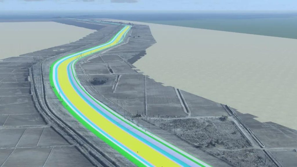
5.2 Aerial Triangulation & Modeling
- Dense point cloud generation
- Mesh construction
- Texture mapping
The project utilized professional photogrammetry software to ensure efficient and accurate reconstruction.
6. Accuracy Verification
Field verification using ground checkpoints showed:
- Horizontal accuracy: better than 10 cm
- Vertical accuracy: better than 10 cm
- In complex terrain: accuracy remained within 20 cm
These results fully meet the requirements of highway survey specifications.
7. Project Value
7.1 Improved Design Efficiency
Compared with traditional 2D surveying, the 3D model enables:
- Faster route comparison
- Better visualization of terrain and structures
- More efficient design iteration
7.2 Enhanced Decision-Making
The high-resolution 3D data supports:
- Engineering planning
- Earthwork calculation
- Risk assessment
7.3 Reduced Field Workload
UAV-based surveying significantly reduces:
- Manual labor
- On-site measurement time
- Safety risks in difficult terrain
8. Conclusion
This project demonstrates that UAV oblique photogrammetry is a highly efficient and reliable solution for highway surveys in complex mountainous areas.
By combining advanced UAV platforms with Riebo’s high-resolution mapping cameras, the project achieved:
- High-precision data acquisition
- Efficient 3D reconstruction
- Strong support for engineering design
About Riebo’s Solution
Riebo’s drone-based mapping camera provides a complete workflow—from data acquisition to 3D modeling—designed for demanding environments such as:
- Mountain highways
- Infrastructure corridors
- Large-scale terrain mapping
With high-resolution imaging, strong environmental adaptability, and efficient processing tools, Riebo’s Drone Mapping Camera help engineering teams achieve faster, safer, and more accurate project outcomes.