With UAV-based oblique photogrammetry being widely applied in surveying, mapping, and smart city development, the accuracy of survey results directly determines project value. However, numerous factors during aerial surveys can interfere with data acquisition and processing, ultimately affecting model precision. Based on field experience and technical research, this article analyzes six core factors that influence the accuracy of oblique photogrammetry and provides targeted recommendations.
1. Weather Conditions
Weather impacts oblique photogrammetry mainly in terms of light and wind, both of which directly affect image quality and UAV flight stability.
From a lighting perspective, the optimal survey time is between 9 a.m. and 3 p.m., when light intensity is moderate and diffuse, reducing excessive brightness contrast on objects. Outside this period, low light or high solar angles can cause shadow-side textures of buildings to become blurry or underexposed, introducing errors in aerial triangulation and weakening both visual quality and geometric accuracy of the model. Fog and haze reduce atmospheric visibility, lowering image clarity and further degrading precision.
Wind is equally critical. Calm or light-wind conditions are optimal. When wind speed exceeds 10 m/s, turbulence disrupts UAV flight attitude and speed, causing image distortion and blurring. Strong winds also drain UAV power faster, shortening flight endurance and potentially leaving survey areas incomplete, delaying project schedules.
2. Flight Path Planning
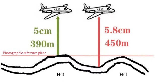
Rational flight path design ensures complete data coverage and consistent resolution, especially in complex terrain. Using a uniform flight altitude in areas with large elevation differences results in insufficient resolution at higher altitudes and redundant resolution at lower ones, undermining overall accuracy.
To address this, a layered flight strategy should be adopted, setting appropriate flight altitudes for different elevation ranges. Terrain-following flight is another key technique, adjusting UAV altitude dynamically to maintain resolution consistency. Flight path orientation should also favor detailed data collection—for example, flying along building facades and between gaps to capture clearer textures, reduce voids, and enhance model quality.
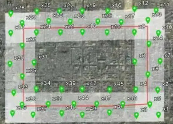
3. Ground Control Point (GCP) Placement
GCPs serve as the foundation for aerial triangulation, with their density and distribution directly affecting coordinate accuracy. By using known ground coordinates of GCPs, image orientation parameters are computed through resection, followed by intersection to obtain object coordinates.
In flat areas, GCPs should be evenly distributed to ensure uniform error propagation during adjustment. In areas with significant elevation variation, denser GCPs are needed to correct image distortion, improving accuracy. Placement strategies should be adapted to survey shape: irregular areas require customized positioning to avoid blind spots, while linear zones (e.g., roads, rivers) need evenly spaced GCPs along the route to ensure coordinate stability.
4. Overlap Rate: The “Bridge” Connecting Images
Overlap rate ensures sufficient tie points between photos. Too little overlap produces insufficient tie points, leading to poor image matching, holes, or tearing in the model. Too much overlap, however, significantly increases data processing load, slowing project progress.
Based on practice, recommended overlap settings are:
- Regular areas: 80% forward overlap, 70% side overlap.
- Dense urban areas: 83% forward, 75% side.
- High-rise zones: at least 60% forward and 50% side overlap at rooftops (except for single-sided parapets) to prevent rooftop voids.
5. Camera Quality: The “Foundation of Raw Images”
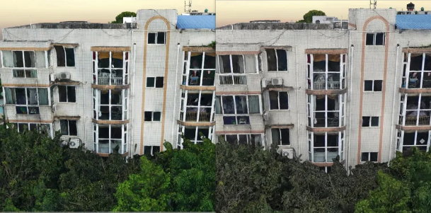
The optical performance of oblique cameras directly determines raw image quality, which is the basis for accurate modeling. Lens distortion and aberration control are particularly important. Excessive distortion warps object shapes, complicating correction, while aberrations cause blurred edges and color shifts, reducing texture clarity.
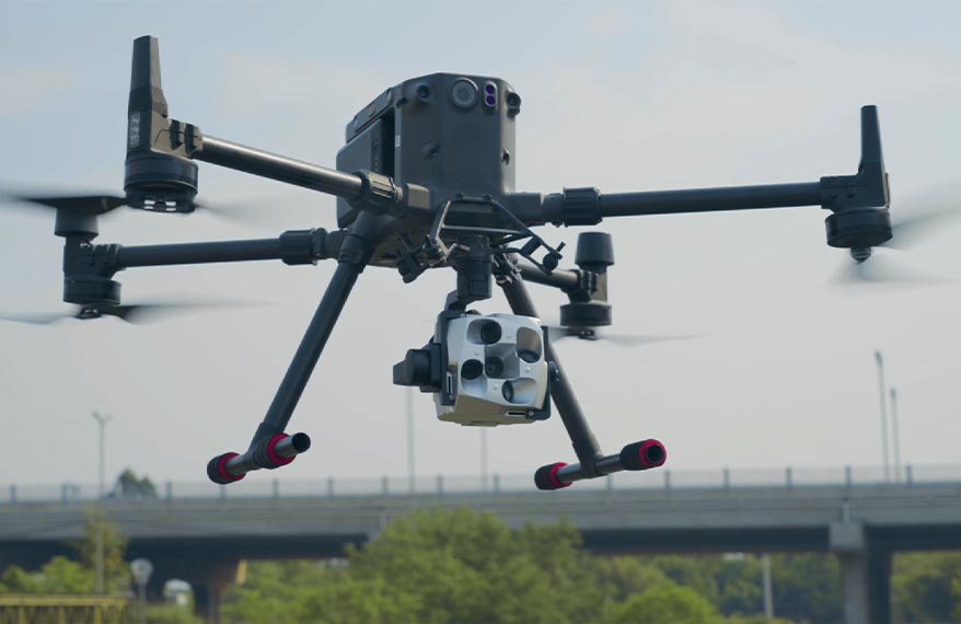
For example, the Riebo DG4Pros camera uses aspherical lenses to keep overall distortion within 0.04%, significantly lowering geometric error. Each lens is also equipped with an extra-low dispersion (ED) element, effectively correcting chromatic aberrations and ensuring accurate color reproduction and clear details. Even under minor UAV attitude changes, the five lenses maintain consistent resolution, improving aerial triangulation success rates and final model accuracy.
6. Exposure Settings: The “Light Regulator” in Image Capture
Exposure time must match real-time lighting conditions. Poor settings cause overexposure or underexposure, which severely affect model accuracy.
In strong light, long exposure can wash out sunlit surfaces, erasing textures, while shadowed areas remain underexposed and unclear. In cloudy or low-light conditions, even longer exposures may fail to capture sufficient detail, producing low-contrast images and reducing texture quality in models. Reflective surfaces, such as glass curtain walls in urban projects, intensify uneven exposure problems.
Cameras with adjustable parameters are critical in such cases. For instance, the Riebo DG4Pros supports customized exposure tuning via proprietary software, allowing users to adapt to real-time lighting. This optimizes image contrast, reduces overexposure/underexposure, and ensures high-quality image capture.
Conclusion
The accuracy of oblique photogrammetry is shaped by multiple interdependent factors—from early-stage weather monitoring and flight path planning to mid-stage GCP placement and exposure control, and finally to equipment selection. Each step requires strict quality control. In practice, solutions should be tailored to project conditions such as terrain, object types, and accuracy requirements. By choosing suitable equipment and professional data processing software, errors can be minimized, ensuring reliable results that meet project demands and support applications in surveying, mapping, and smart city development.