As digital cities and smart urban governance systems continue to grow, the demand for high-precision 3D city models is rapidly increasing. National-level initiatives such as “Realistic 3D China” aim to build a comprehensive 3D geographic database to support modern infrastructure and digital governance.
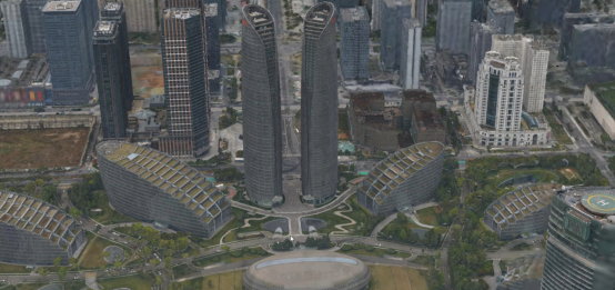
In this context, a practical 3D city modeling project was conducted in the central urban area of Chengdu, focusing on high-resolution, ground-control-free oblique photogrammetry using drones. The target was not only to build an accurate 3D model of the Chengdu Global Center area but also to ensure seamless data fusion across different acquisition times.
1. Survey Area Overview
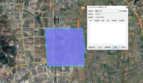
The survey area is located in the High-Tech Zone of Chengdu, characterized by flat terrain and densely clustered high-rise buildings with an average height of approximately 100 meters. The total area covered in this campaign was 6.67 km², with 4.39 km² of the area successfully imaged during the flight campaign.

2. Equipment Selection
Urban environments create unique challenges for UAV photogrammetry:
- High-rise buildings increase risk of UAV loss of control or collisions.
- Building density causes occlusion and texture complexity, making data acquisition difficult.
- Reflective surfaces (glass curtain walls, polished stone, painted facades) create challenging lighting conditions.
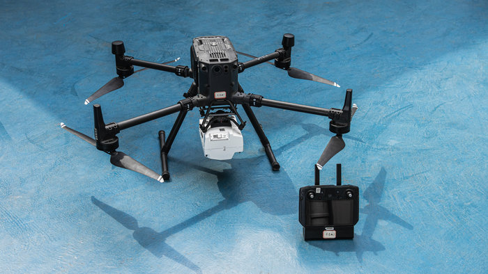
To address these issues, the RIEBO DG4Pros oblique photogrammetry camera was deployed. Its optimized optical design and multiple-lens configuration ensure:
- Reduced lens aberration for clearer imagery
- High imaging stability in complex urban environments
- Compatibility with medium to large UAV platforms
3. Flight Mission Planning
The flight mission was carefully designed to optimize data quality and coverage:
- Flight altitude: 130 meters
- Ground Sampling Distance (GSD): 5 cm
- Flight overlap: 70% forward, 80% side
- Total images captured: 27,550
- 10 separate flight sorties
This configuration ensured that the imagery met the precision and completeness requirements for successful 3D reconstruction.
4. Data Processing Workflow
4.1 Aerial Triangulation
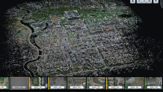
Data processing utilized Mirage3D software with six networked nodes of powerful workstations. The large dataset (40,932 images) was processed in parallel, ensuring efficient aerial triangulation and initial alignment.
4.2 3D Model Fusion
After solving aerial triangulation in Mirage3D, the aligned results were imported into ContextCapture for model generation and fusion. The combined workflow allowed:
- Elimination of model gaps or misalignment
- Seamless merging of data from two separate imaging campaigns
- No need for additional manual adjustments
5. Model Visualization and Outputs
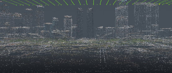
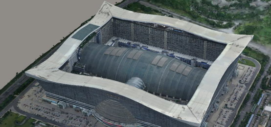
The final 3D model of the Chengdu Global Center area exhibited high geometric fidelity and visual detail, with buildings, roads, and urban features accurately represented. This dataset provides a strong foundation for urban digital applications.
6. Practical Applications
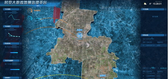
The real-world 3D model was integrated into a smart city governance platform as part of a larger urban digital twin ecosystem. Key applications include:
- Big data integration: Combines GIS, inspection data, and urban metadata
- AI-assisted governance: Enables automated urban monitoring and analysis
- Decision support: Provides city administrators with reliable data for planning and operations
This project serves as a powerful example of how high-precision 3D city models can enhance urban decision-making and digital transformation efforts.
7. Project Summary and Best Practices
Urban 3D modeling using UAV-based oblique photogrammetry demands meticulous planning and execution. From pre-flight calibration (compass & IMU) to optimized camera selection and flight path planning, this case demonstrated:
- Stable and accurate image capture even in dense urban conditions
- High success in aerial triangulation without data loss or misalignment
- Efficient data fusion between multiple capture campaigns
The project confirms that oblique photogrammetry with advanced mapping cameras such as the DG4Pros can consistently produce reliable, high-precision urban models — even when imaging data is collected over different time periods.