In aerial surveying over areas with significant elevation differences, traditional fixed-altitude flights often result in uneven data precision — for instance, between mountain valleys and peaks or between low-rise and high-rise buildings in urban settings. Such discrepancies can cause major inconsistencies in modeling and mapping accuracy.
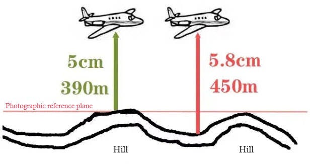
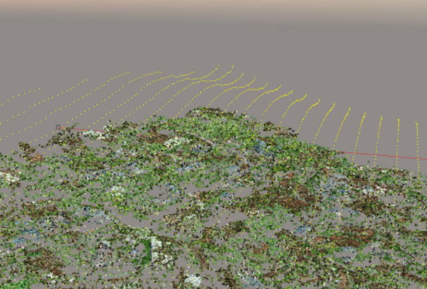
Terrain-following flight addresses this issue by allowing drones to maintain a constant relative altitude above the ground. Using preloaded 3D terrain data, the UAV automatically adjusts its flight height, ensuring uniform ground resolution across the entire survey area. This article outlines the essential steps, key technical considerations, and risk-control practices for implementing terrain-following flights effectively in mapping projects.
Core Implementation Stages of Terrain-Following Flight
A successful terrain-following operation follows a structured process: data preparation → flight route planning → ground control point (GCP) setup. Each step directly affects the quality and accuracy of the final deliverables.
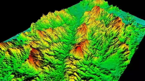
(1) Preparing the Base Terrain Model: Choosing the Right Data Source
The terrain model serves as the UAV’s “eyes.” Currently, two main data sources are used: custom-generated DSMs and public DEM datasets. Choosing between them depends on the survey area’s complexity:
| Data Type | How It’s Obtained | Advantages | Ideal Scenarios | Key Notes |
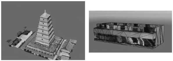
| Custom DSM | 1. Conduct a preliminary 2D orthophoto flight at “highest elevation +150m”.2. Process images with Pix4Dmapper or similar to generate a DSM.3. Import DSM into the drone controller. | High precision, accurately reflects terrain and structures. | Urban areas with varied building heights or dense obstacles. | Requires an initial full-area flight; higher operational cost and risk. |
| Public DEM | 1. Download DEM data from sources such as SRTM (90m), ASTER GDEM (30m), or ALOS (12.5m).2. Divide flight zones based on terrain and elevation variation (50m overlap between zones).3. Import data for standard route planning. | Time-saving, no need for extra flights. | Rural, mountainous, or open terrain with limited high structures. | Limited resolution; less precise in complex terrain. Avoid signal-blocking zones. |
(2) Flight Route Planning: Precision Design Based on Terrain Zones
Route planning should align with the data zones to ensure seamless data coverage. Key focus areas include:
- Overlap zones: Maintain at least 50m of overlap between routes to prevent data gaps.
- Obstacle avoidance: Bypass known structures such as power lines or telecom towers.
- Safety buffer: Account for terrain uncertainty by leaving a vertical clearance margin based on field reconnaissance.
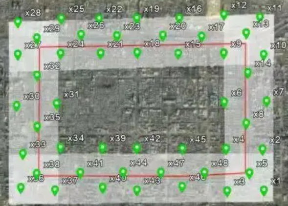
(3) Ground Control Points (GCPs): Ensuring Mapping Accuracy
GCPs anchor the geometric accuracy of aerial triangulation and final mapping. Distribute them evenly across the area, prioritizing visible, flat, and unobstructed surfaces (e.g., road intersections, concrete markers). Avoid shaded, wet, or easily disturbed areas. Ensure GCPs cover terrain edges and zones with high elevation variation.
Key Operational Considerations: Managing Risks and Efficiency
Terrain-following flights typically occur in complex environments, making them more risk-prone than standard missions. Effective pre-flight, in-flight, and post-flight management is crucial.
(1) Pre-Flight: Field Inspection & Equipment Check
- Field reconnaissance: Inspect for electromagnetic interference sources (power lines, radar stations) and unmarked tall obstacles (trees, temporary structures).
- Equipment precheck: Examine motors, propellers, and communication links. Fully charge batteries and confirm GPS functionality (≥10 satellites at takeoff).
(2) In-Flight: Real-Time Monitoring & Emergency Response
- Battery monitoring: Begin return procedures when power drops below 20%. Replace batteries showing abnormal discharge patterns.
- GPS signal stability: Maintain at least 10 satellites. If the signal drops, ascend or switch to manual mode and avoid known interference zones.
(3) Trial Flight: A Safety Rehearsal Before Full Operation
Conduct a short test flight along a representative section of the terrain to validate:
- UAV response to height adjustments
- DSM/DEM and actual terrain match
- Video transmission stability
If deviations or lags occur, adjust terrain data or flight parameters before proceeding.
Conclusion
Terrain-following flight is a cornerstone technology for accurate aerial surveying in complex terrain. Beyond improving data precision, it minimizes operational risks through systematic planning and monitoring. By adhering to the principles of “accurate data, meticulous planning, and proactive risk control,” surveyors can ensure both flight safety and high-quality mapping results — building a reliable foundation for all subsequent project deliverables.