1. Project Background
Creating digital archives for historic buildings plays a crucial role in cultural heritage preservation. High-precision 3D models generated through oblique photogrammetry provide reliable baseline data for future conservation work while enabling researchers to conduct remote analysis anytime and anywhere.
For example, the restoration of Notre-Dame Cathedral in Paris after the fire relied heavily on previously created high-precision digital models. These models became essential references for reconstruction and preservation.
Similarly, building a digital archive for Jiayuguan not only supports long-term preservation but also enhances tourism promotion, allowing more visitors to explore the historical site both virtually and physically.
2. Site Introduction and Model Overview
Jiayuguan, located in northwest China, experiences strong sunlight and clear weather in October, producing warm lighting conditions that highlight architectural details.
Key characteristics of Jiayuguan Fortress include:

- Outer wall perimeter: 733 meters
- Inner city area: approximately 25,000 square meters
- Wall height: about 10.7 meters
- Complex architecture including towers, gates, temples, and defensive structures
The fortress consists of multiple interconnected structures, including:
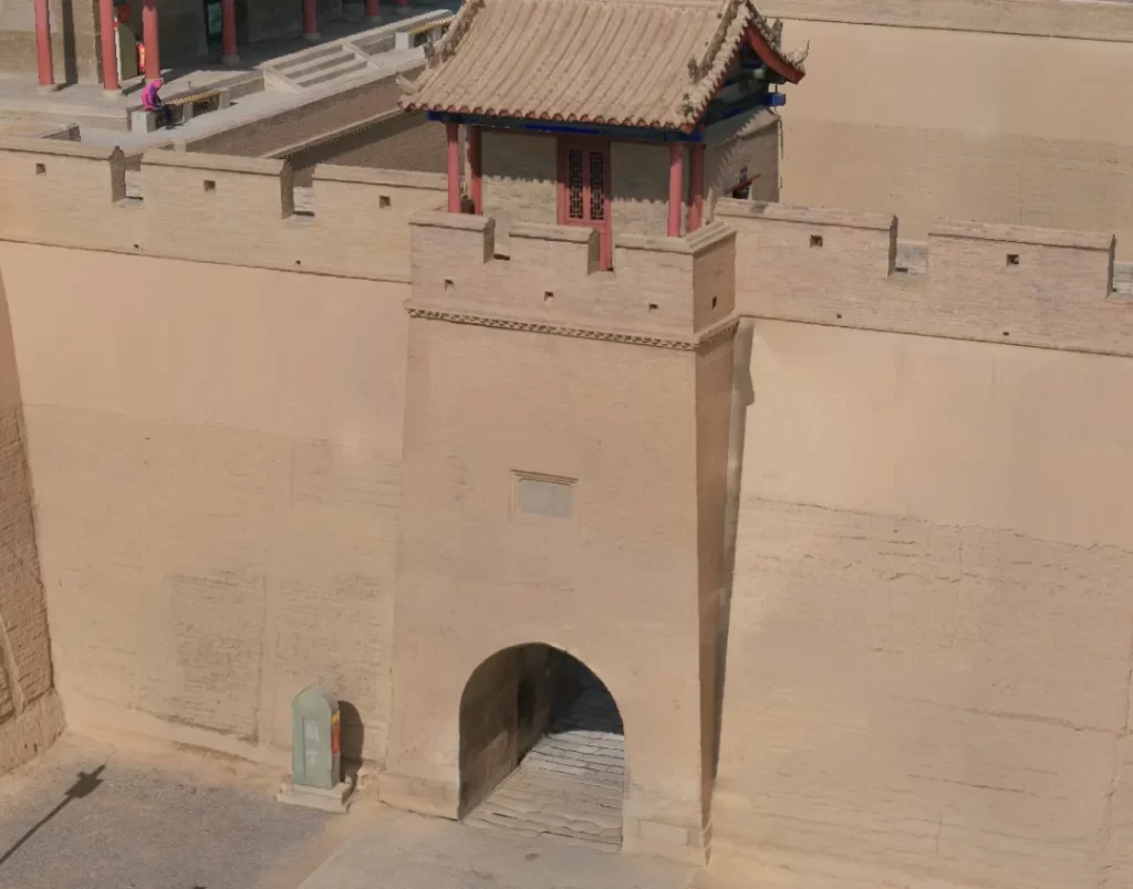
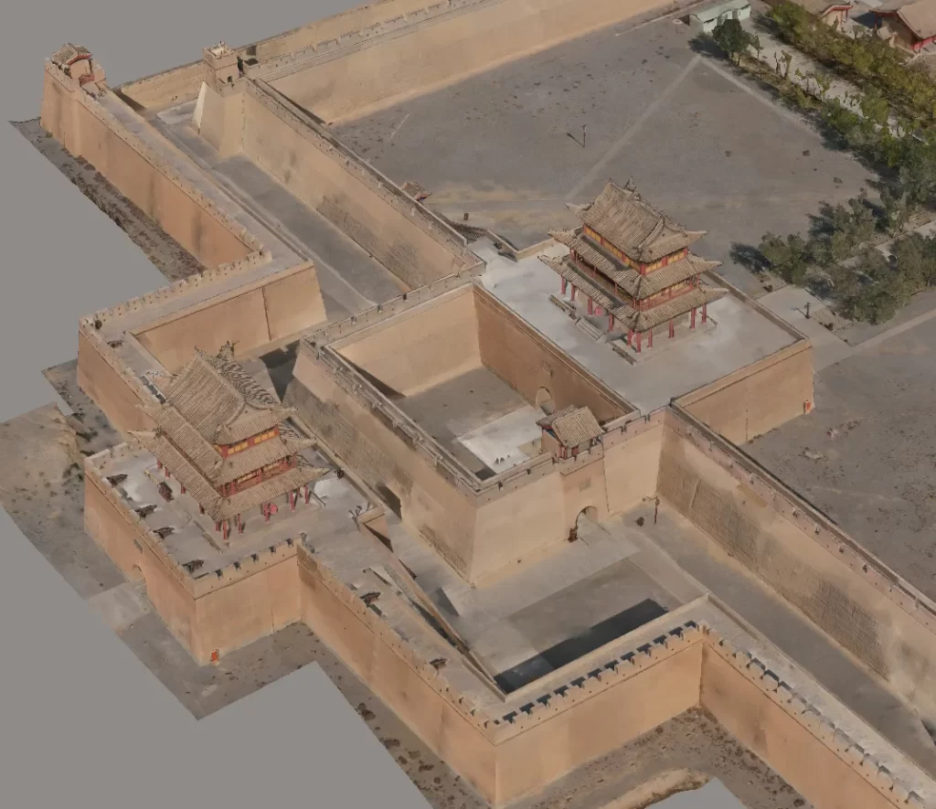 Outer city walls
 Inner fortress
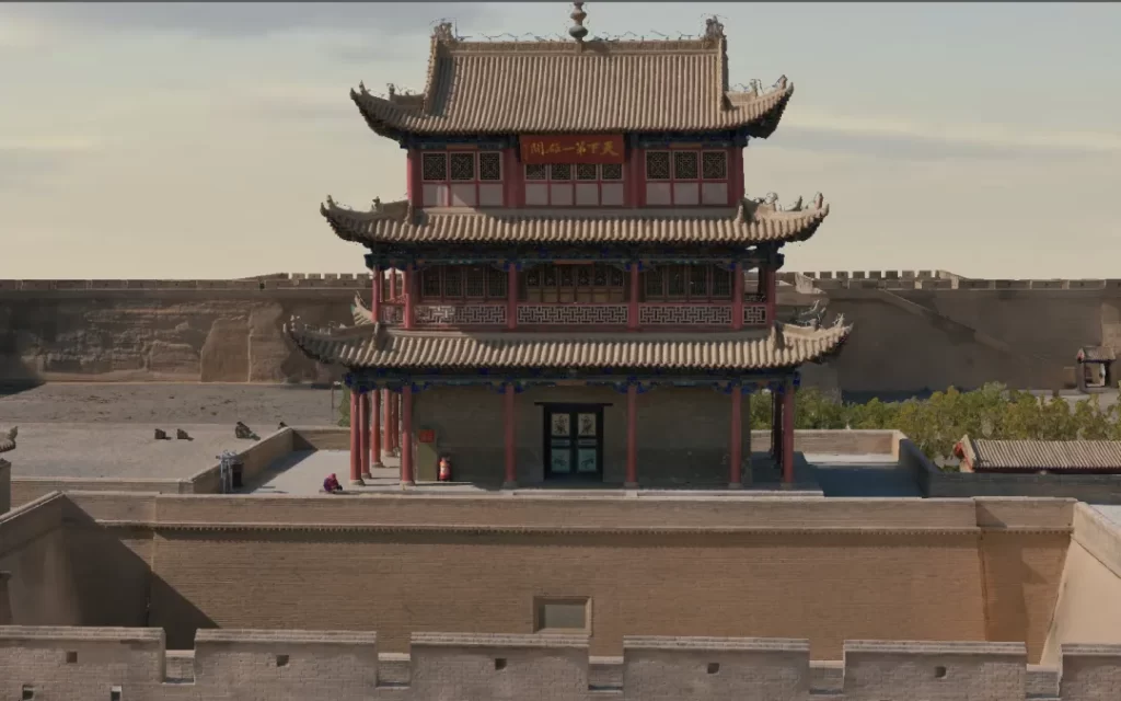
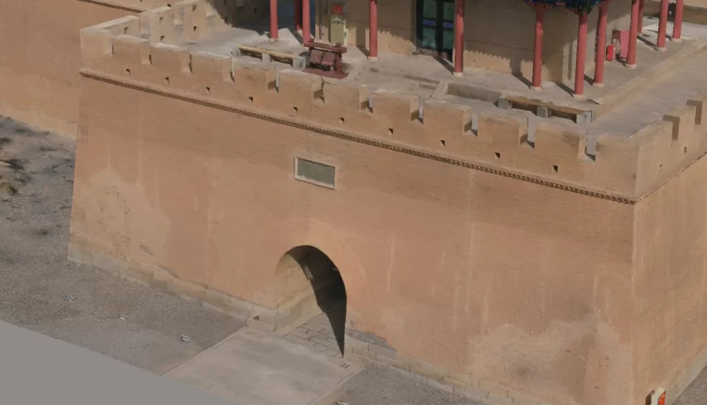 Gate towers
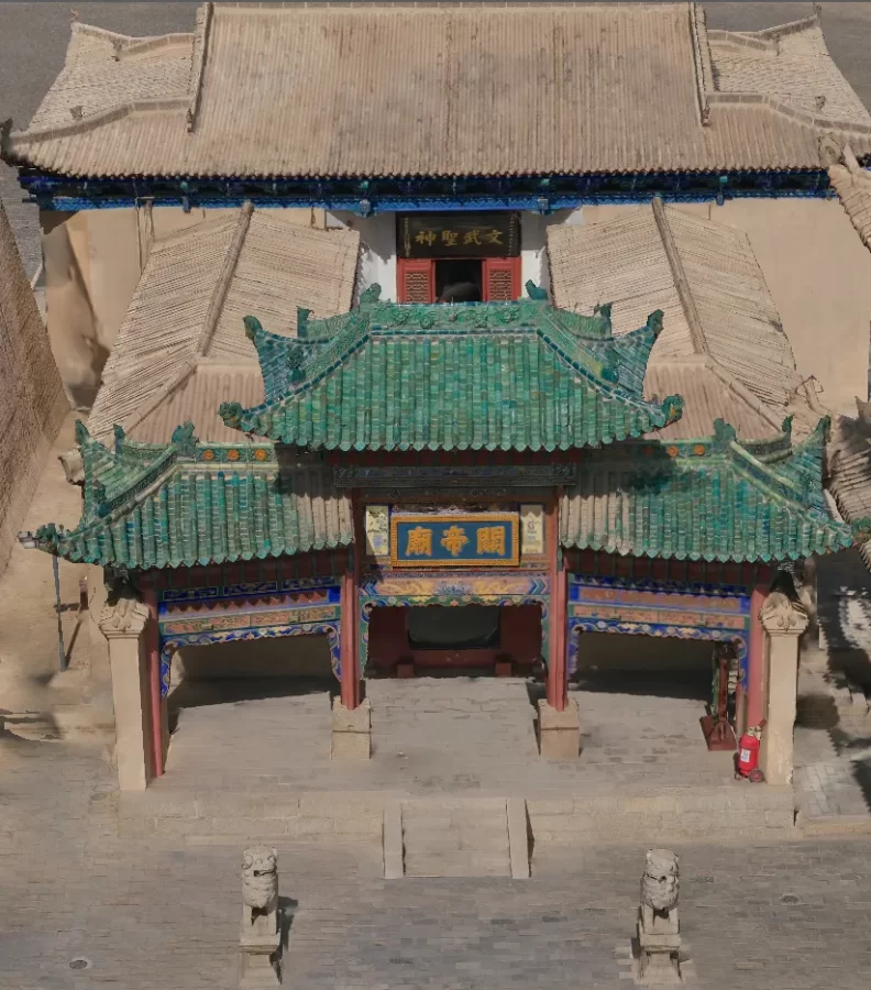 Wenchang Pavilion and Guandi Temple
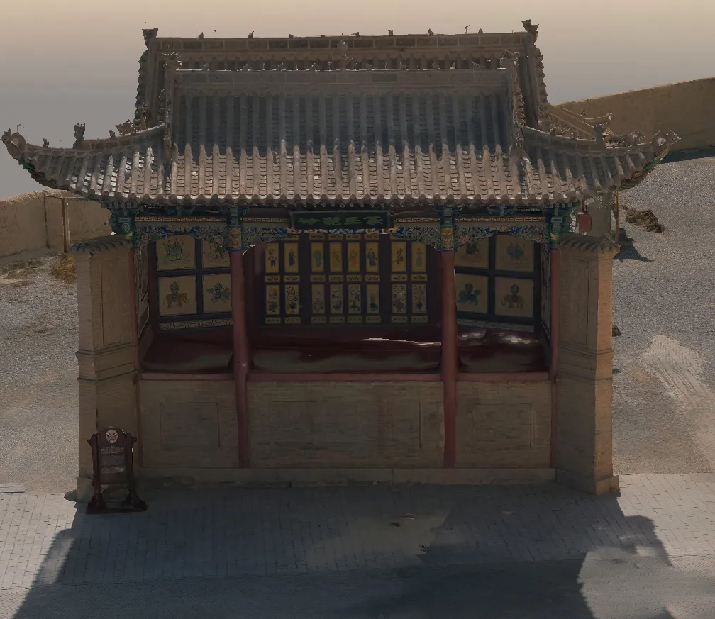 Opera stage
 Defensive tower
 Corner tower
These complex architectural elements create an ideal use case for high-precision 3D modeling.
3. Project Implementation
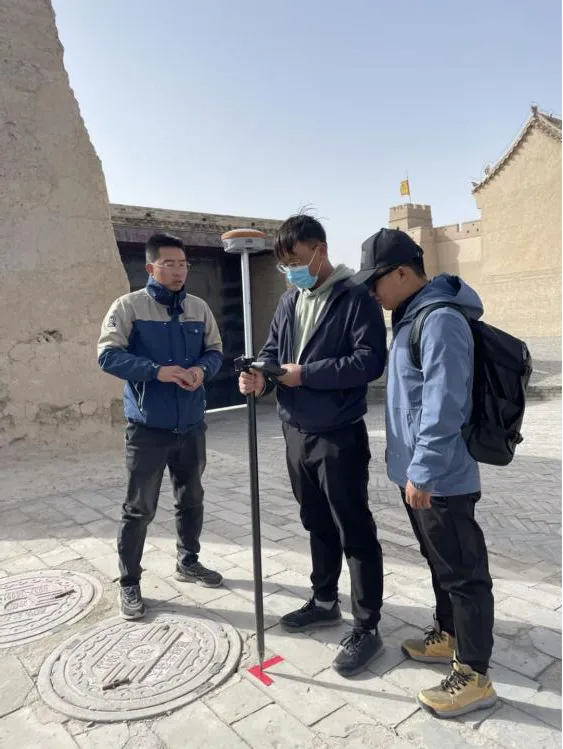
3.1 Equipment Selection and Ground Control
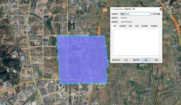
The survey area covered approximately 0.1 km², with elevation differences of about 20 meters and the tallest buildings reaching 30 meters. The complex layout of towers and walls created challenges for precise modeling.
 Surveying and mapping team
Environmental conditions also added difficulty:
- Continuous wind throughout the day
- Wind speeds of 8–10 m/s
- Complex building structures
To address these challenges:
- Drone Platform: DJI M300 RTK
- Camera: Riebo M10Pro medium-format mapping camera
- Ground Control Points: 9 control points placed using L-shaped markers
- Coordinate System: CGCS2000 with 1985 elevation system
- Measurement Method: RTK multiple measurements averaged for accuracy
3.2 Flight Route Planning
The workflow began by using Rainpoo Route Assistant to generate a full-coverage circular flight route. This allowed the creation of a coarse 3D model, which served as the base for planning more detailed facade flights.
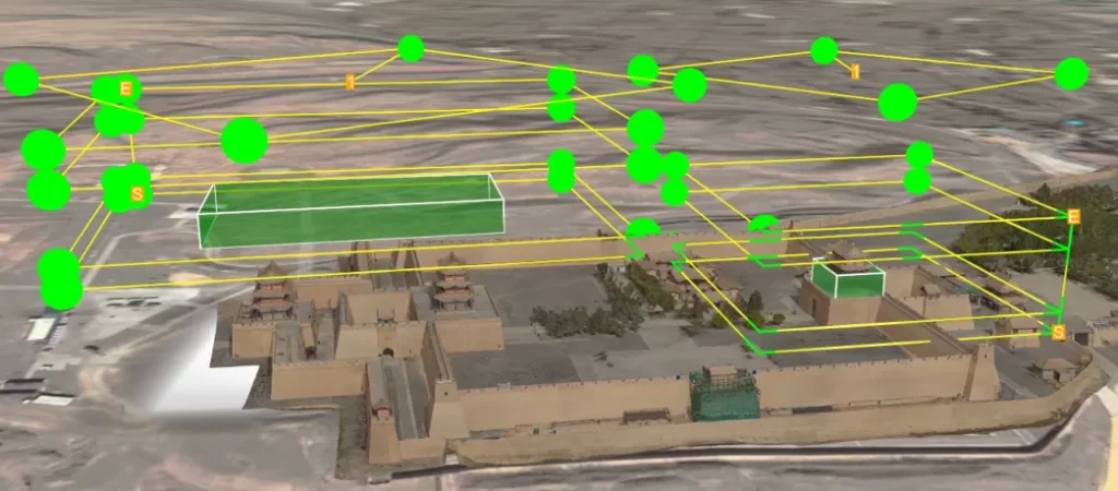
Due to the complex architecture—such as:
- Overhanging eaves
- Hollow structures
- Multi-layer towers
Additional facade flight routes and concentric circular routes were designed to capture multi-angle, high-precision data.
Some areas with occlusions required manual supplementary flights to ensure complete coverage.
4. Project Results and Summary
Data Collection
- Total flights: 14
- Images captured: ~5,000
- Processing software: Smart3D
- Output: High-precision 3D model
After model reconstruction, ground control point accuracy was verified to ensure modeling precision.
Camera Performance
The Riebo M10Pro features:
- 100-megapixel medium-format CMOS
- Self-developed MLE optical lens
- MS mechanical shutter
- High sharpness and low distortion imagery
These features enabled high-precision data capture and improved modeling accuracy.
Why This Project Matters
This project demonstrates how drone-based oblique photogrammetry can:
- Preserve historical architecture digitally
- Support restoration planning
- Improve tourism visualization
- Enable remote research
- Reduce survey time and cost
How Riebo Supports Cultural Heritage 3D Modeling
Riebo’s drone mapping solutions combine:
- High-resolution medium-format cameras
- Intelligent flight route planning
- Accurate positioning technology
- Advanced 3D reconstruction workflows
These technologies enable:
- High-precision digital twin creation
- Large-scale heritage documentation
- Complex structure modeling
- Long-term infrastructure monitoring
Whether for historic buildings, bridges, dams, or urban environments, Riebo’s drone mapping solutions provide efficient and accurate data acquisition for digital preservation and analysis.