In the rapidly evolving field of cadastral surveying, efficiency and precision are key drivers for technology adoption. The traditional requirement of setting extensive ground control points (GCPs) has long been a bottleneck, consuming time and labor while exposing field teams to remote and challenging terrain conditions.
To address this, the Yunnan Institute of Geological and Mineral Surveying collaborated with RIEBO Technology to validate whether high-precision 1:500 topographic mapping could be achieved without ground control points using a fixed-wing UAV equipped with the RIEBO DG4Pros oblique photogrammetry camera.
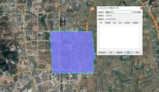
Survey Area
Project Overview
- Location: Qilin District, Qujing City, Yunnan Province, China
- Objective: Test the feasibility of producing a 1:500 topographic map without external ground control points
- Survey Area: Approximately 4.57 km² of relatively flat terrain with elevation differences within 10 m
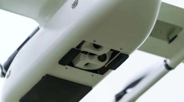
- Equipment: Fixed-wing UAV platform + RIEBO DG4Pros oblique photogrammetry camera
- Date of Test: September 2, 2019
- Technology Focus: PPK (Post-Processed Kinematic) without GCPs for high-precision positioning
Why This Case Matters
While drones have already revolutionized aerial mapping by reducing project time from months to weeks or days, ground control deployment remains a major challenge—especially in remote or difficult terrain. Removing the need for GCPs without sacrificing accuracy can dramatically improve field efficiency and safety.
Flight Planning and Equipment Setup
Fixed-Wing UAV and Camera Integration
The team selected a fixed-wing UAV platform because of its extended flight endurance and speed, which are essential for covering large areas efficiently. The RIEBO DG4ProS camera was chosen due to its advanced features: fast shutter interval (0.6 seconds), full-frame CMOS sensor, and excellent optical performance—key factors that support high-precision image capture even at survey speeds.
Survey Parameters
- Overlap: 80% forward, 70% side overlap
- Image Resolution: Targeted for ~3 cm ground sampling
- Control Points: No traditional ground control points used—instead, PPK data were leveraged to enable accurate aerial triangulation
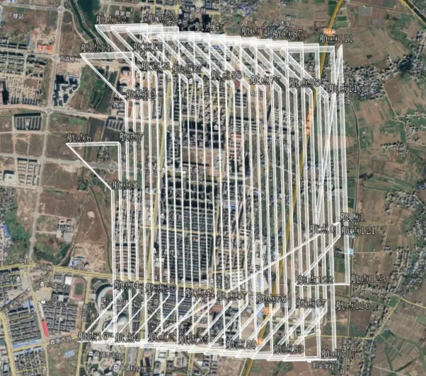
- Data Collection: Nearly 9,475 images captured across the terrain
Data Processing Workflow
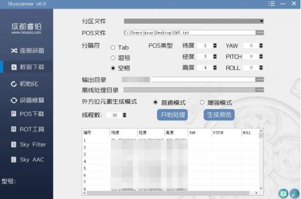
Smart Preprocessing
Raw image data were first processed with SkyScanner preprocessing software, which filters out redundant or low-value images and prepares the dataset for modeling. By removing about 24% of invalid images, the workflow became more efficient without compromising modeling quality.
PPK-Enhanced Aerial Triangulation
Despite the absence of ground control points, the introduction of PPK data allowed precise positioning of images in 3D space. Thanks to DG4Pros’ highly accurate synchronization capabilities among its five lenses, the resulting aerial triangulation delivered reliable results suitable for high-precision topographic mapping requirements.
Accuracy Verification and Results
To validate the mapping precision:
- The model was compared against RTK ground measurements from field check points.
- The RMS reprojection error was controlled to approximately 0.51 pixels, confirming that the model met the national 1:500 terrain survey accuracy standards without any GCPs.
Conclusion
This case demonstrates that high-precision cadastral mapping at 1:500 scale can be successfully achieved using:
- A fixed-wing UAV platform for efficient wide-area coverage
- The RIEBO DG4Pros oblique photogrammetry camera for high-quality image capture
- PPK positioning techniques replacing traditional ground control methods
The success of this project highlights the potential for safer, faster, and more cost-effective cadastral surveys—especially in challenging environments where deploying GCPs is difficult or impractical.
As oblique photogrammetry and drone technologies continue to evolve, they will play a pivotal role in transforming land surveying workflows worldwide.


