Project Snapshot
| Item | Details |
| Project | Sanchahe Super Major Bridge exterior inspection (client anonymized) |
| Location | Qinghai Province, China — Qinghai–Tibet Railway corridor |
| Bridge Type | Continuous rigid-frame railway bridge |
| Inspection Scope | Deck underside, all piers (up to 54.1 m), bearings, full-bridge exterior |
| Inspection Method | UAV + LiDAR + Photogrammetry |
| Key Technologies | Autonomous flight planning, AI defect detection, 3D digital twin, defect 3D localization |
| Project Period | 20–23 September 2024 (3 field days) |
Project Overview
Sanchahe Super Major Bridge is the tallest bridge on the Qinghai–Tibet Railway, a high-altitude railway corridor known for cold climate, strong winds and demanding operating conditions. The bridge is a 690.19 m continuous rigid-frame structure with 20 piers, 17 of which are circular thin-walled hollow piers, the tallest reaching 54.1 m above ground.
As part of the client’s regular inspection programme, the bridge required a full exterior assessment of the deck underside, every pier, the bearings and the overall surface condition. The inspection had to produce high-resolution imagery of difficult-to-reach areas, 3D data for archiving, and a structured digital record suitable for future maintenance planning and reporting to higher authorities.
The inspection focused on the deck underside, all pier shafts and bearings, plus general exterior condition. The primary objective was to complete a reliable periodic inspection without disrupting railway operations and to establish a traceable digital baseline for the bridge.
Due to the combination of 54 m-high thin-walled piers, cold and windy high-altitude conditions, and a working railway line that could not be closed, the project required a method that could collect reliable inspection data from areas beyond the safe reach of personnel — without stopping traffic.
Inspection Challenges
Challenge 01 — Reaching 54.1 m Thin-Walled Hollow Piers
Seventeen of the bridge’s 20 piers are circular thin-walled hollow shafts, the tallest standing 54.1 m high. Their curved, large-surface geometry makes them difficult to access with conventional equipment: personnel cannot approach closely, and working at that height in cold, high-altitude conditions with strong winds carries serious safety risk. Any solution had to inspect the full pier height, top to bottom, without putting workers at height.
Challenge 02 — A Working Railway That Cannot Be Closed
The bridge carries busy railway traffic. Conventional inspection would have required erecting inspection platforms or using rope-access personnel, with track closures and traffic control for an estimated 7 days. Under-bridge inspection vehicles are not applicable on this bridge, and any interruption to a main-line railway has high operational and economic cost. The inspection method therefore had to work entirely clear of the live railway — with zero track closure.
Challenge 03 — Producing a Traceable Digital Record
The client needed more than a written report. Requirements included 3D bridge data, high-resolution imagery of key areas, and a digital bridge archive usable for periodic comparisons, maintenance decisions and reporting to higher authorities. Manual inspection methods typically produce paper-based, hard-to-compare records that cannot be re-visited or quantified — exactly what the client wanted to avoid.
RIEBO’s Drone Bridge Inspection Solution
To address these requirements, RIEBO deployed its Drone Bridge Inspection Solution, combining a DJI M400 RTK industrial UAV with the RIEBO SF10 inspection camera, LiDAR, AI-assisted defect detection and RIEBO’s proprietary inspection data management platform.
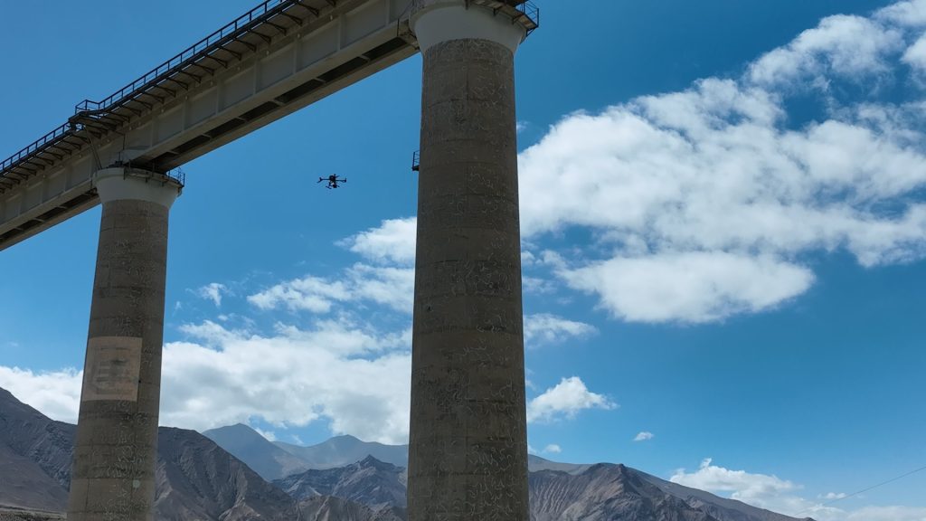
A DJI M400 RTK was flown with RTK positioning for repeatable, centimetre-level navigation around the structure, carrying the RIEBO SF10 inspection camera to capture high-resolution imagery of the pier shafts, deck underside and bearings. The platform’s wind resistance and industrial design made it operable in the bridge’s cold, gusty high-altitude environment.
LiDAR + Photogrammetry 3D Reconstruction
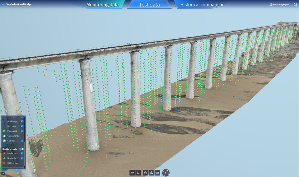
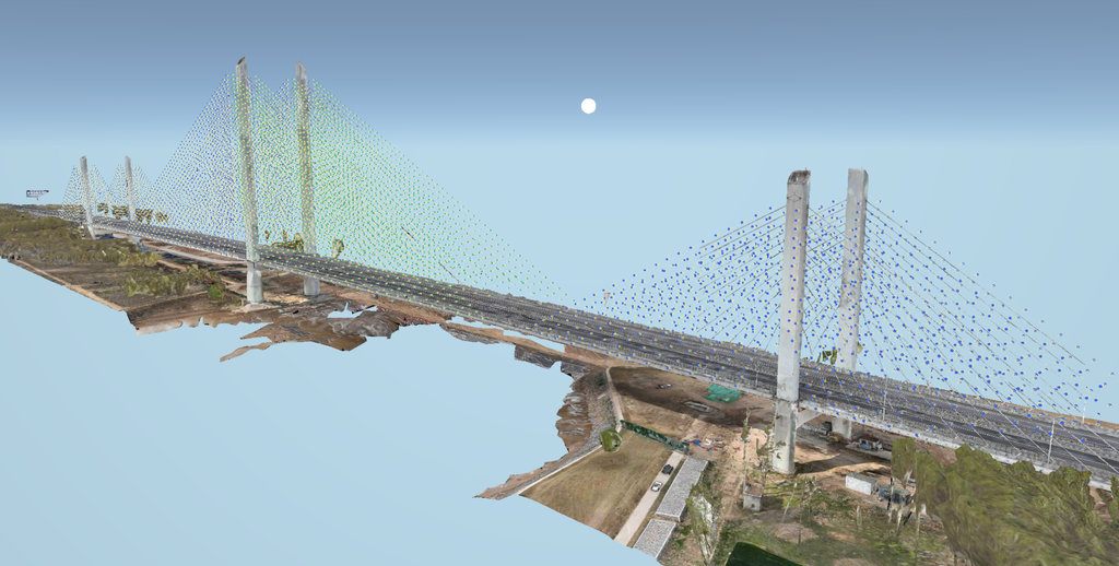
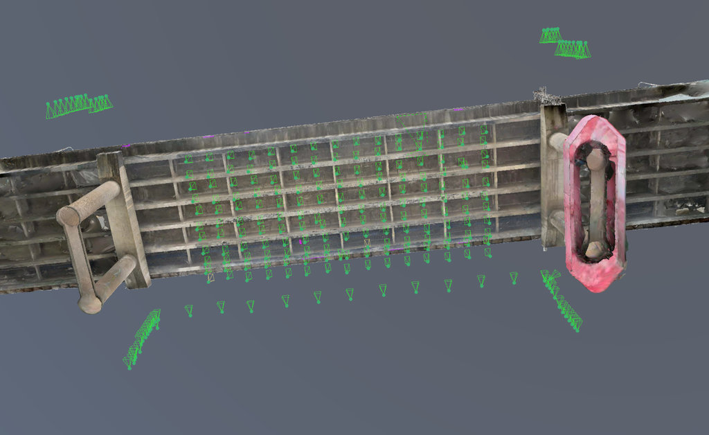
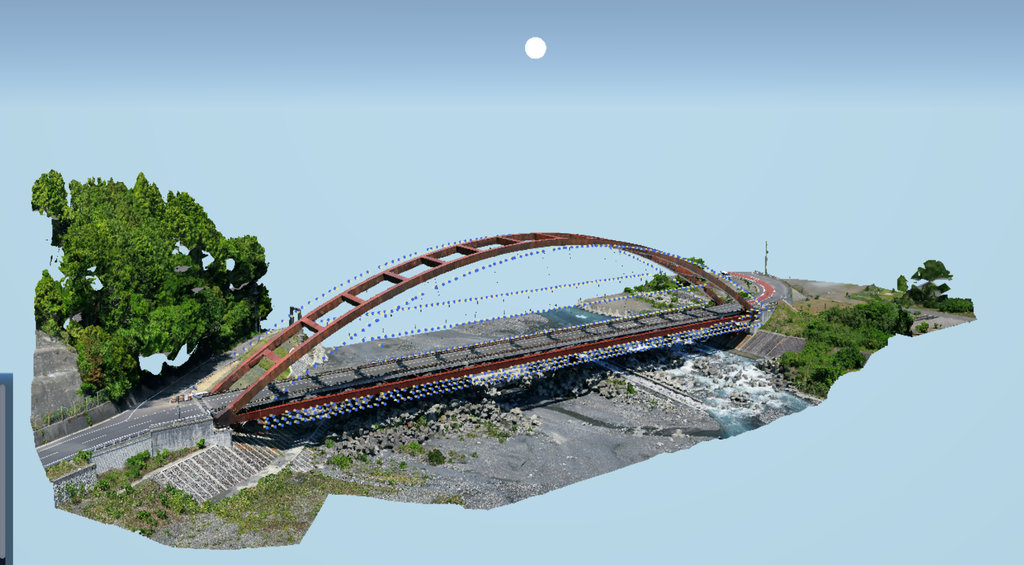
LiDAR and photogrammetry were used to generate the bridge’s 3D model and point cloud before and during data acquisition. The model served two purposes: it provided the geometric reference for automatic flight-route planning around the structure, and it became the foundation of the bridge digital twin in which inspection results are visualized and archived.
AI Defect Detection with 3D Localization
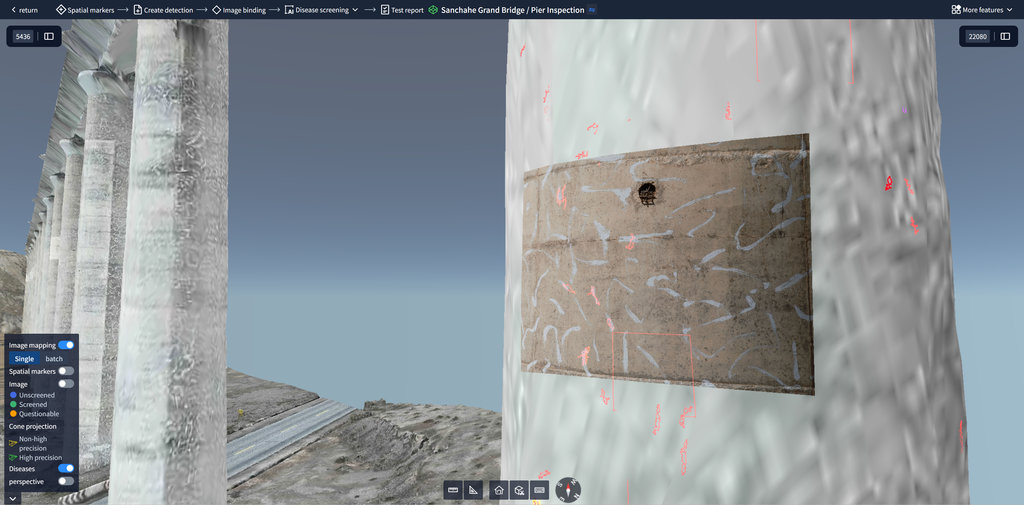
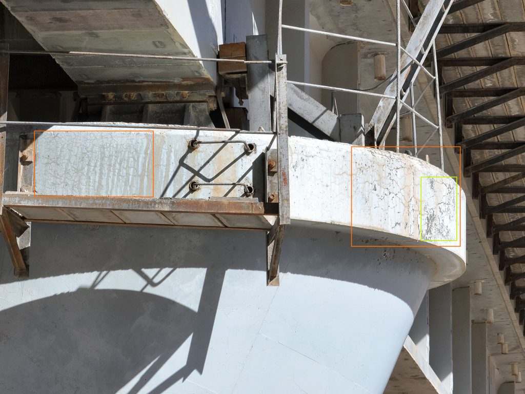
Captured imagery was processed through RIEBO’s AI-assisted defect detection, which identifies cracks, concrete spalling, exposed rebar and surface damage. Each detected defect was then linked to its position in the 3D model, producing spatially localized defect records rather than disconnected photos. All records were consolidated in RIEBO’s proprietary inspection data management platform for reporting and future comparison.
Inspection Workflow
01. Inspection Planning
Inspection scope was defined — deck underside, all 20 piers, bearings and full-bridge exterior — together with flight conditions suited to the high-altitude, windy site.
02. 3D Modeling / Route Planning
LiDAR and photogrammetry produced a 3D model of the bridge; automatic flight routes were planned against it to cover pier surfaces and the deck underside systematically.
03. UAV Data Acquisition
The DJI M400 RTK with RIEBO SF10 camera flew the planned routes, collecting high-resolution imagery of all target areas.
04. Data Processing
Images were processed for georeferencing and model alignment; point cloud and 3D model data were consolidated into a unified inspection dataset.
05. AI-Assisted Defect Detection
RIEBO’s AI model screened the imagery for cracks, concrete spalling, exposed rebar and surface damage.
06. Defect Localization & Visualization
Each defect was associated with its coordinates in the 3D model, allowing inspectors and clients to view damage in its actual structural position within the digital twin.
07. Inspection Reporting
The inspection data management platform generated the inspection report and the digital bridge archive delivered to the client.
Technology & Equipment
UAV Platform
DJI M400 RTK — RTK centimetre-level positioning, wind resistance and industrial-grade protection, suited to high-altitude and strong-wind operation.
Inspection Camera
RIEBO SF10 — dedicated inspection camera for high-resolution defect imagery (full specifications to be confirmed from project records).
LiDAR / Photogrammetry
LiDAR for 3D point clouds; photogrammetry for oblique 3D reconstruction — jointly producing the model used for route planning and digital twin generation.
AI Analysis
RIEBO’s AI-assisted defect recognition covering cracks, spalling, exposed rebar and surface damage; detection results are linked to imagery and 3D positions.
Inspection Management Platform
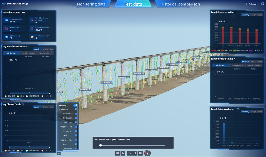
RIEBO’s proprietary platform stores the 5,436 images, point cloud, 3D model and 24,216 defect records, and supports report generation and baseline comparison in future inspection cycles.
From Inspection Images to Structured Data
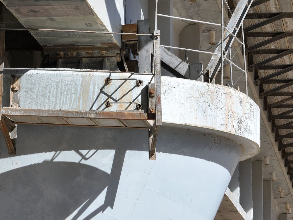
The project transformed raw UAV inspection imagery into a structured inspection dataset through the following workflow:
Image Acquisition → Data Processing → AI Analysis → Defect Localization → Inspection Records
Original Inspection Image
AI Detection Result
3D / Digital Twin Result
Inspection Platform
Inspection Results
Result 01 — 3 Days Instead of 7, With Zero Track Closure
Manual inspection was estimated at 7 days with track closures and traffic control. The drone operation completed the same scope in 3 field days, with no track closure and no disruption to railway operations.
Result 02 — 100% Deck Underside Coverage Across All 20 Spans
The inspection covered the full bridge: all 20 spans of deck underside (100% of underside components) and all 20 piers, including the 54.1 m tallest pier — the area most difficult to reach by any other method.
Result 03 — 5,436 Images and a 3D Digital Twin
The project produced 5,436 high-resolution inspection images plus a LiDAR point cloud and 3D model. The digital twin gives the client a measurable, navigable record of the structure as it stands today.
Result 04 — A Baseline Digital Archive of 24,216 Defect Records
A total of 24,216 defects were detected, localized in 3D and recorded — all general defects with none classified as critical. This establishes the bridge’s first fully digital defect baseline, enabling objective comparisons in future inspection cycles and evidence-based maintenance decisions.
Project Data
| Metric | Result |
| Bridge Components Inspected | 20 spans, 20 piers (17 hollow thin-walled), bearings, deck underside |
| Inspection Area | 100% deck underside; all piers incl. 54.1 m tallest pier |
| Images Collected | 5,436 |
| 3D Model Coverage | full-bridge 3D model |
| Potential Defects Identified | 24,216 (all general defects; none critical) |
| AI Recognition Accuracy | 93% |
| Inspection Duration | 3 field days (vs 7 days planned for manual inspection) |
| Other Verified Metric | Zero track closure; no disruption to railway operations |
Project Benefits
Operational Benefits
- No track closure and no disruption to railway operations
- 3 field days vs 7 days planned for manual inspection — more than 57% shorter
- Eliminated the safety risk of personnel working at height on 54.1 m piers
Data Benefits
- Traceable digital archive: 5,436 images, point cloud and 3D model
- Defects localized in 3D and viewable directly in the digital twin
- Digital baseline enables objective comparison in future inspection cycles
Inspection Management Benefits
- Defects, imagery and positions consolidated in one proprietary platform
- Structured data supports maintenance decisions and reporting to higher authorities
- Foundation for life-cycle maintenance management of the bridge
Key Takeaways
This inspection of the Qinghai–Tibet Railway’s tallest bridge demonstrates that autonomous UAV inspection with AI defect detection can safely cover areas — 54 m hollow piers, live-railway undersides — that conventional methods cannot reach without closure and risk. The 3-day operation produced a traceable digital archive: 24,216 defects localized in 3D, a digital twin, and a baseline that turns one inspection into a reusable asset for the bridge’s entire life cycle.
The project demonstrates how UAV inspection with AI defect detection can support regular railway bridge inspection at high altitude while producing a structured, traceable digital dataset — without interrupting operations.
Related RIEBO Solutions
Drone Bridge Inspection
Bridge Digital Twin
LiDAR and photogrammetry-based 3D reconstruction for as-built archives and baseline comparison.
AI Defect Detection
Automated recognition of cracks, spalling, exposed rebar and surface damage with 3D localization.
Digital Asset Management
A proprietary platform for storing, managing and comparing inspection data across cycles.
Related Questions
Can drones inspect bridge undersides?
How accurate is drone bridge inspection?
How is bridge inspection data managed?
Have a Bridge Inspection Project?
Tell us about your bridge, inspection scope and project requirements.
Request a Project Assessment
Or explore the complete RIEBO Drone Bridge Inspection Solution.